Explore
 Shop
Shop About
About Search
Overview Index
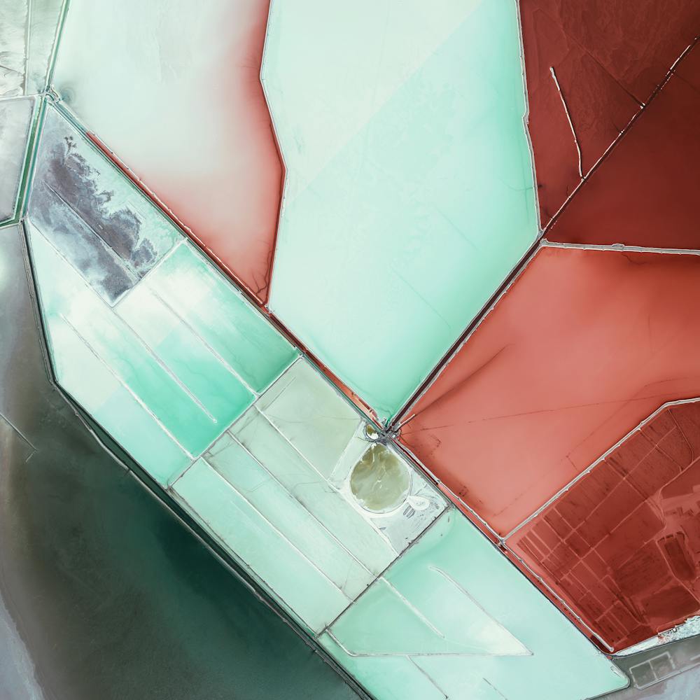
Evaporation ponds
40.792726°, -112.592892° - Great Salt Lake, UtahEvaporation ponds in the Great Salt Lake, Utah are pictured in this Overview. The Great Salt Lake contributes an estimated $1.3 billion annually to Utah’s economy, including $1.1 billion from industry, which is mostly due to mineral extraction. Minerals extracted from the lake include sodium chloride, potassium sulfate, and magnesium-chloride.
Maxar Technologies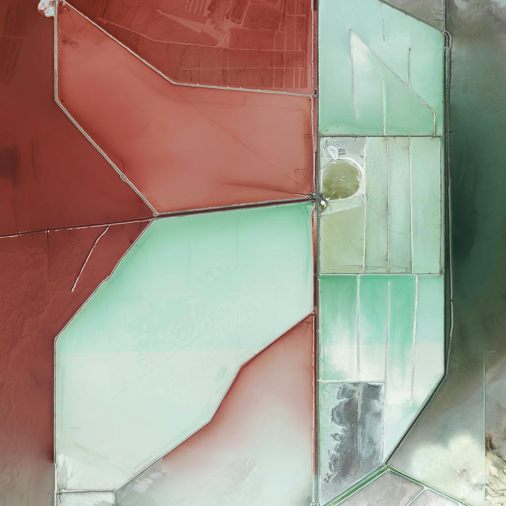
Everglades National Park
25.364334°, -81.121068° - Florida, United StatesEverglades National Park in Florida is the largest tropical wilderness in the United States east of the Mississippi River, covering more than 1.5 million acres. The park was established in 1934 to protect the area’s fragile ecosystem and is home to 36 threatened or protected species including the American crocodile and West Indian manatee.
Maxar Technologies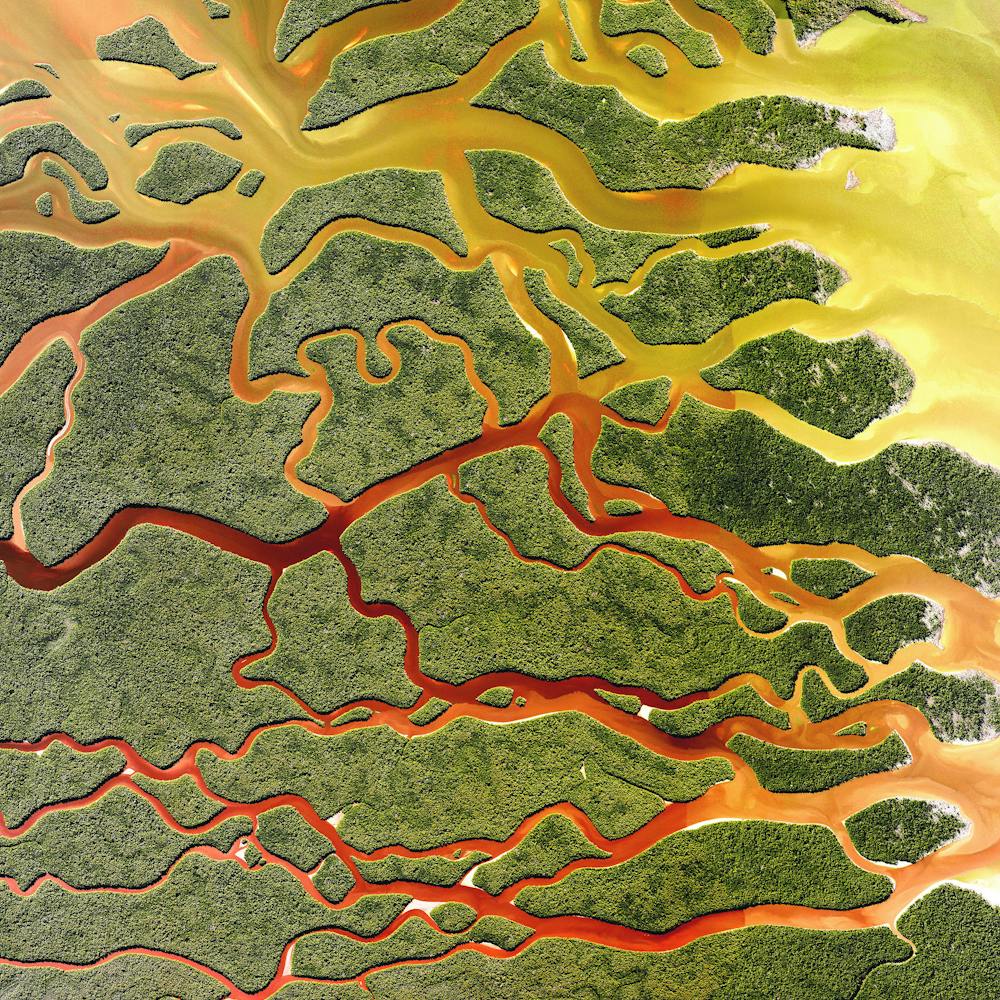
Fall Foliage in Nashua, New Hampshire
42.760321°, -71.484009° - Nashua, New HampshireColorful fall foliage blankets the landscape around Nashua, New Hampshire. With the arrival of autumn and colder temperatures in the northeastern United States, leaves begin to change colors and create vibrant views like this one. Thousands of tourists flock to New Hampshire (and the rest of New England) during this season to take advantage of scenic drives and “leaf-peeping” tours.
Nearmap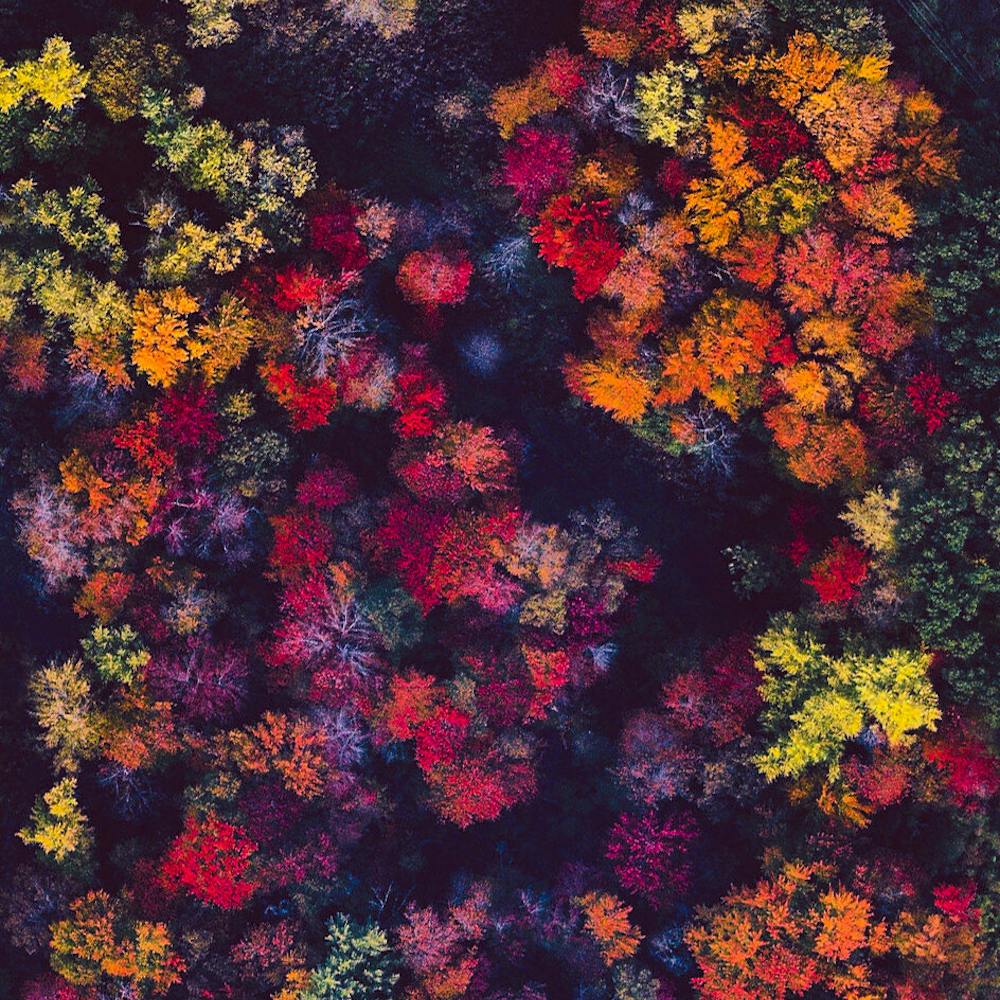
Fallon Range Training Complex
39.878094°, -118.398102° - Dixie Valley, Nevada, USAThe Fallon Range Training Complex is a United States Navy military area that spans 84,000 acres in the Dixie Valley of Nevada, USA. The complex primarily hosts air-to-air and air-to-ground training exercises. Here we see an installation of metal containers that are used for covert operations training as well as instrument recognition and calibration for spy planes and satellites.
Maxar Technologies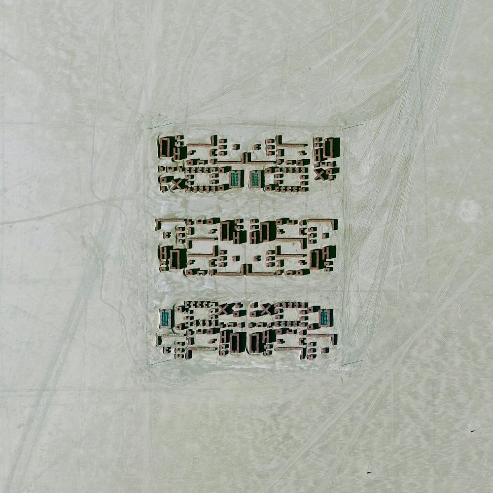
Ferrari World
24.483239°, 54.607439° - Abu Dhabi, United Arab EmiratesFerrari World is an amusement park located on Yas Island in Abu Dhabi, United Arab Emirates. Covering 86,000 square meters, it claims to be the world’s largest indoor theme park and contains "Formula Rossa" - the world's fastest roller coaster.
Maxar Technologies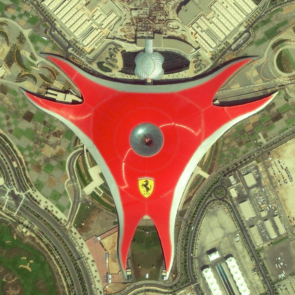
Fes el Bali
34.061111°, -4.977778° - Fez, MoroccoFes el Bali is the oldest walled part in the city of Fez, Morocco. With a total population of 156,000, the area is believed to be the biggest car-free urban neighborhood in the world due its narrow streets that are only two feet wide in some sections.
Maxar Technologies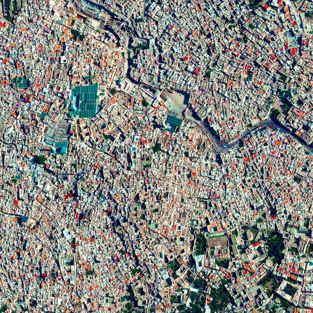
Fish Springs National Wildlife Refuge
39.858056°, -113.366944° - Utah, USAFish Springs National Wildlife Refuge is a wetland oasis in the Great Basin Desert of western Utah, USA. Covering nearly 18,000 acres (7,284 hectares), it is home to a variety of fish, migratory birds, deer, coyotes, pronghorn, cougars and other native species. Fish at the refuge are left over from the ancient Lake Bonneville, which receded 14,000 years ago.
Nearmap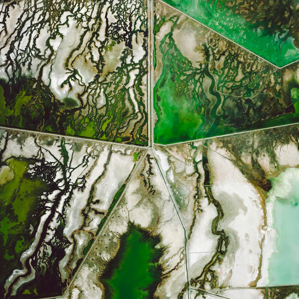
Fortaleza
-3.718333°, -38.542778° - Fortaleza, BrazilWaves rolls into the coast of Fortaleza, Brazil. Located on the Atlantic Ocean, Fortaleza has nearly 25 kilometers (16 miles) of urban beaches.The city serves the state capital of Ceará in the northeast of the country and is home to roughly 2.3 million people.
Maxar Technologies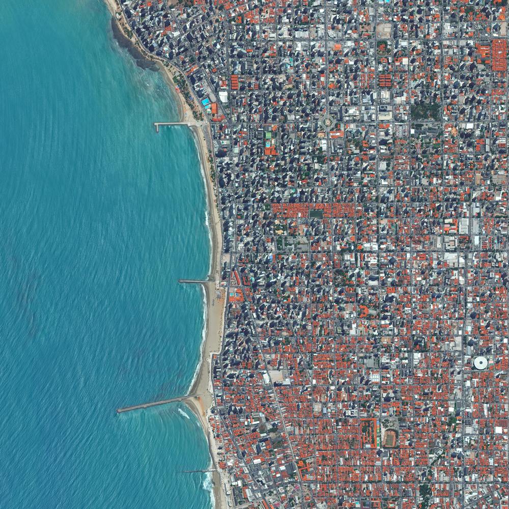
Foxe Basin
67.000000°, -78.000000° - 67.000000°, -78.000000°Large chunks of swirling ice are seen here in Foxe Basin, Nunavut, Canada. Located between Baffin Island and Melville Peninsula, the shallow oceanic basin is blocked by ice for most of the year (this image was captured in July). Foxe Basin supports a high density of bearded seals and the largest walrus herd in Canada. It is also an important summering area for bowhead and beluga whales and narwhal.
United States Geological Survey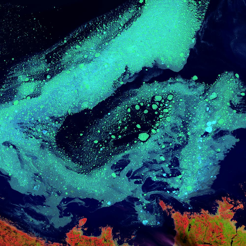
Frankfurt Airport
50.033333°, 8.570556° - Frankfurt, GermanyFrankfurt Airport is the busiest airport in Germany, averaging 1,365 flights per day and 65 million passengers per year. With more than 70,000 employees, the airport it is also the single largest workplace in the country.
Maxar Technologies
French Frigate Shoals Airport
23.748888°, -166.154887° - French Frigate Shoals, Hawaii, USAFrench Frigate Shoals Airport is a private airfield on Tern Island in French Frigate Shoals, Hawaii. Located roughly 560 miles northwest of Honolulu, the airport has a coral surface that is 3,000 feet long, 200 feet wide, and sits just six feet above sea level. It is owned by the U.S. Fish and Wildlife Service and is only used for emergencies.
Maxar Technologies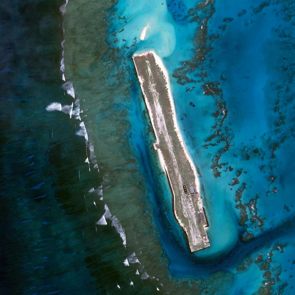
Friedenau
52.471692°, 13.328281° - Berlin, GermanyFriedenau is a neighborhood in the southwestern suburbs of Berlin, Germany. The streets and squares of Friedenau are laid out in a geometric urban design known as a Carstenn Figure. This type of plan is characterized by a circular road that is divided by central avenue.
Maxar Technologies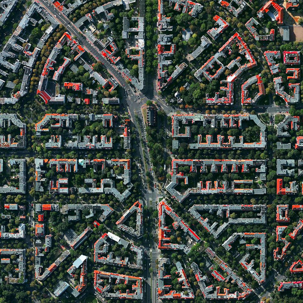
Fruit orchards
37.714546°, -6.532834° - Huelva, SpainFruit trees swirl on the hills of Huelva, Spain. The climate here is ideal for this growth with an average temperature of 17.8° C (64° F) and a relative humidity between 60% and 80%.
Maxar Technologies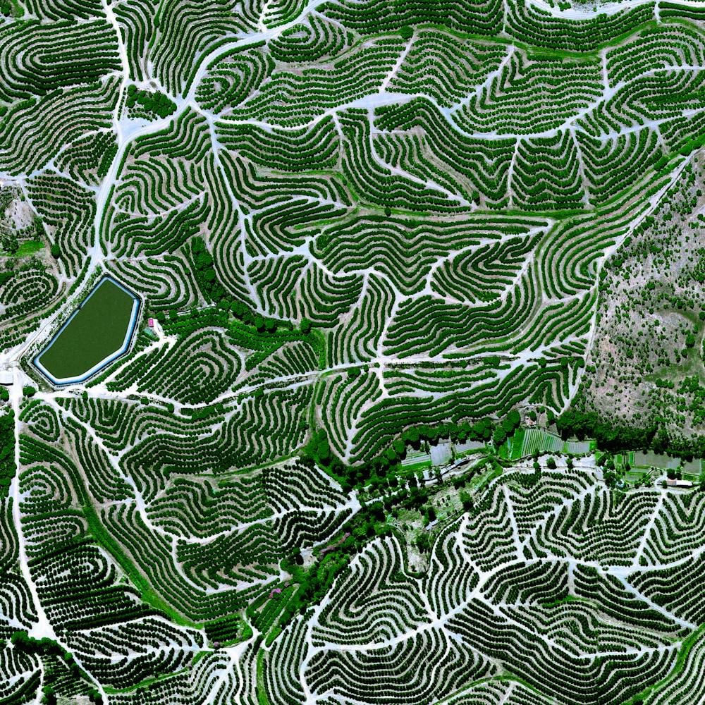
Fucino Plain
42.004370°, 13.529060° - Abruzzo, ItalyThe plain of Fucino in the Abruzzo region of Italy is commonly recognized for the quality of the vegetables that are grown here - in particular the potatoes, carrots, and radishes. What is now an entire plain filled with farms was once Fucine Lake, the third largest lake in Italy. The lake was drained in 1877 to make agricultural development possible here, an area that is now responsible for roughly 25% of the agricultural production in the region.
Maxar Technologies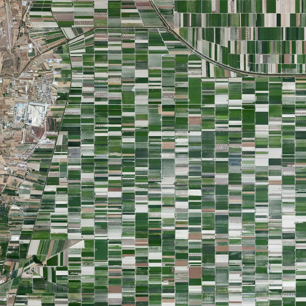
Gardens of Versailles
48.808056°, 2.108333° - Versailles, FranceThe Gardens of Versailles are situated across 2,000 acres of land behind the Palace of Versailles, 19 kilometers (12 miles) outside of Paris. The grounds are landscaped in the classic French garden style, including one section known as The Orangerie - an area seen here at the upper right that contains more than one thousand (primarily orange) trees.
Maxar Technologies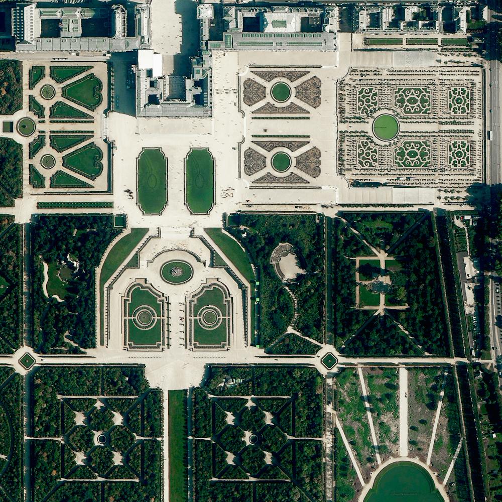
Gibraltar International Airport (GIB)
36.151111°, -5.349722° - GibraltarThe Overview captures the Gibraltar International Airport, serving the British overseas territory and neighboring areas of southern Spain. Winston Churchill Avenue - the road to the border with Spain - intersects the airport runway and has to be closed every time a plane lands or departs.
Maxar Technologies
Glacial melt
63.775112°, -18.096280° - Skafta River, IcelandGlacial melting and flooding occurs every year by the Skafta River in Iceland. As the water travels down towards the North Atlantic Ocean, incredible patterns are created on the hillsides. Rising lava, steam vents, or newly opened hot springs can all cause this rapid ice melt, leading to a sizable release of water that picks up sediment as it flows down from the glaciers.
Maxar Technologies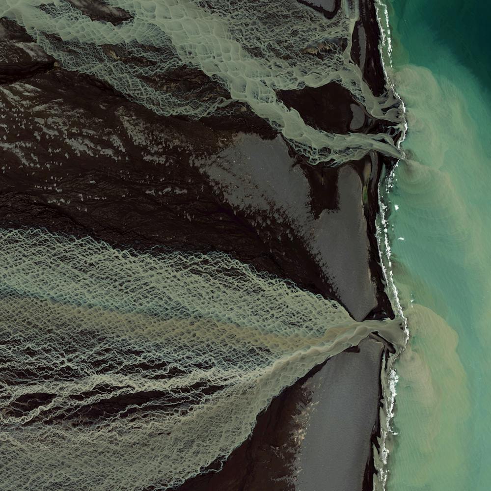
Glacier melt
63.806677°, -17.543741° - IcelandHundreds of tiny streams caused by glacier melt, merge together in the southern region of Iceland to form an outlet into the North Atlantic Ocean. Rising lava, steam vents, or newly opened hot springs can all cause this rapid ice melt, leading to a sizable release of water that picks up sediment as it flows down from the glaciers.
Maxar Technologies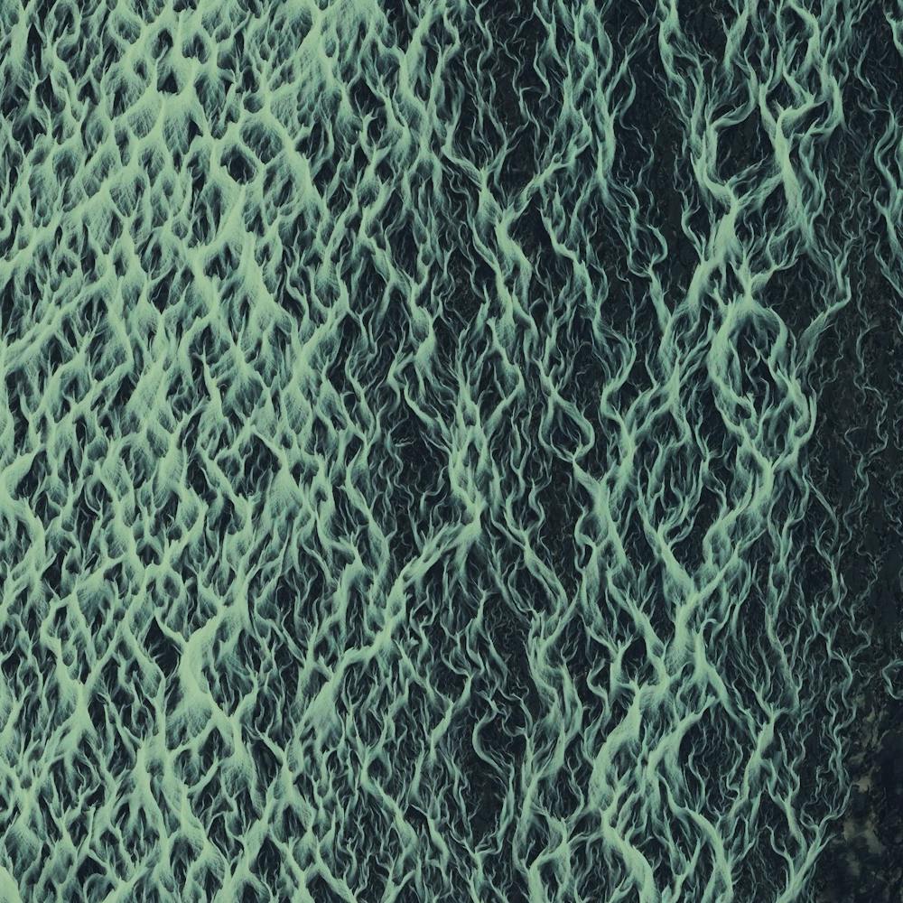
Glastonbury Festival
51.148500°, -2.714000° - Pilton, Somerset, EnglandThe Glastonbury Festival concluded yesterday in Pilton, England. The annual, five-day music event was attended by more than 135,000 people. Concert-goers are provided a campsite at the venue but must bring their own tents - which vividly dot the landscape in this Overview. The population of Pilton on the other 360 days of the year is 998.
Maxar Technologies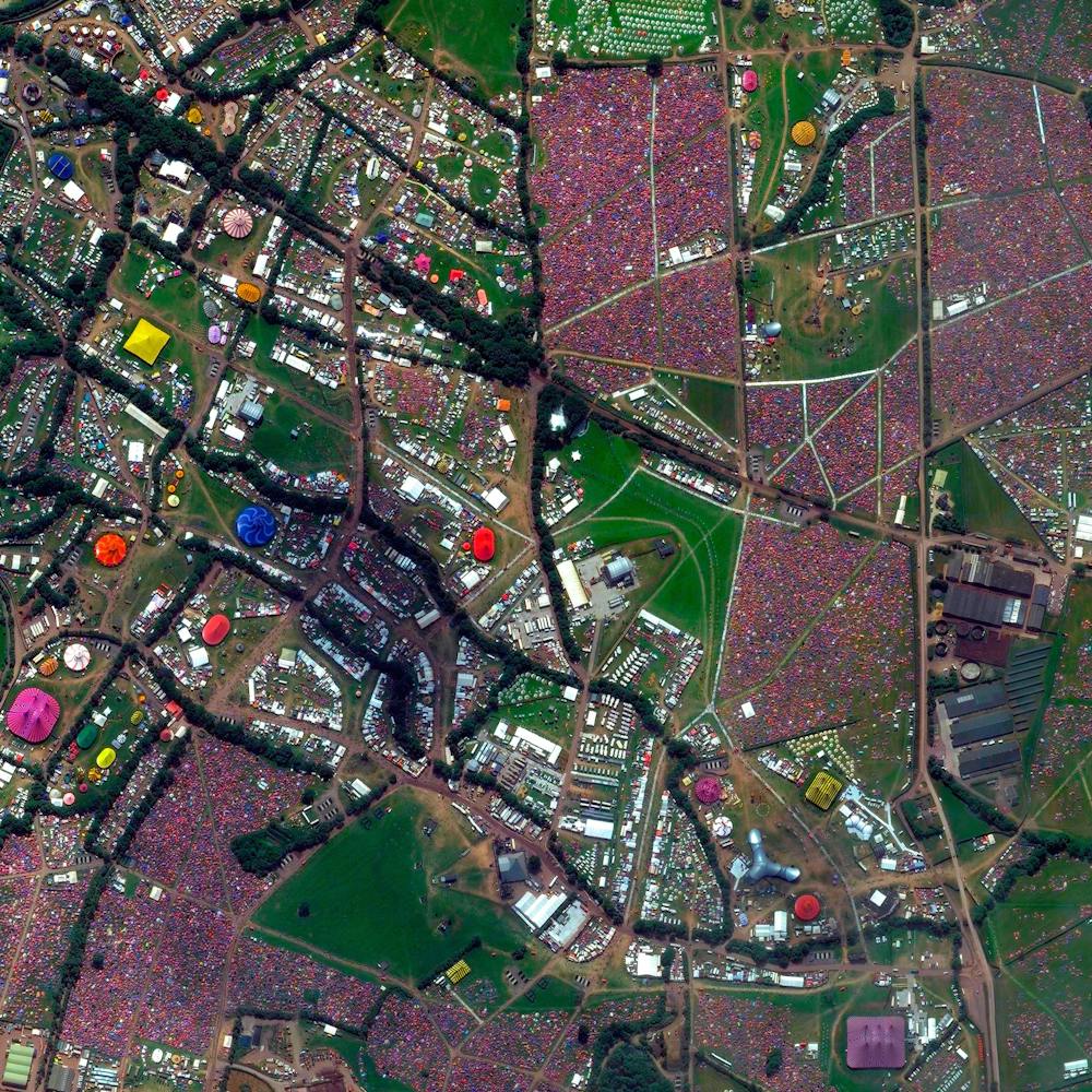
Glen Lake
44.865845°, -85.948776° - Michigan, USAGlen Lake is a lake in northwestern Michigan, USA, located just offshore Lake Michigan. It consists of two bodies of water connected by a narrow channel — "Big Glen Lake" and "Little Glen Lake," which together cover about 6,300 acres (25.5 sq. km) of surface area. With its surrounding wooded sand hills and remarkably clear water, Glen Lake is considered by many to be one of the most beautiful lakes in the Great Lakes Region.
Maxar Technologies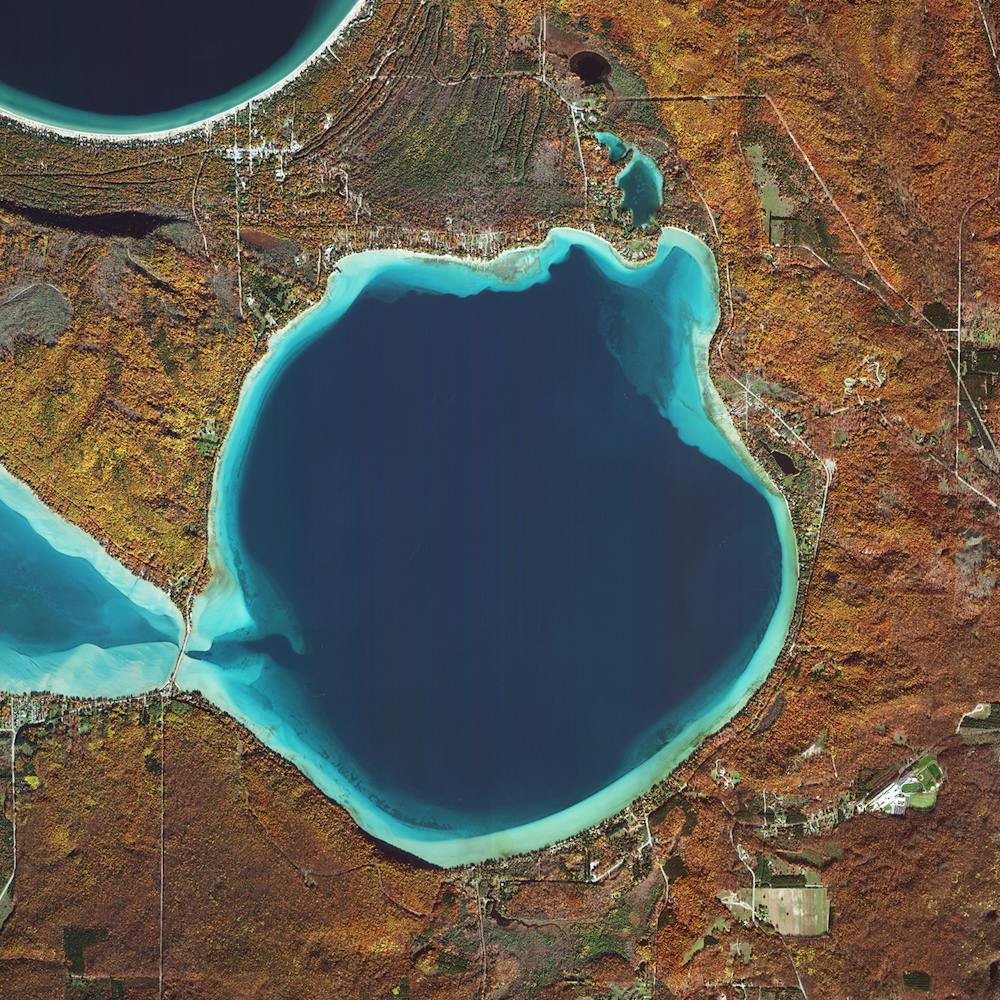
Gobustan National Park
40.164582°, 49.298363° - Gobustan, AzerbaijanThe landscape of Gobustan National Park in Azerbaijan is slivered by hundreds of ravines - narrow canyons that are created by flowing water over a long period of time. This site is best known for a series of elaborate rock engravings that were created here between 5,000 and 40,000 years ago.
Maxar Technologies
Gold Coast Surfers
-28.125333°, 153.485889° - Queensland, AustraliaSurfers float in the waters at Currumbin Alley, a surf break in the Gold Coast Region of Queensland, Australia. This location is ideal for novice and first-time surfers, as waves first crash into a rocky point and then roll gently inland toward Currumbin Creek. Including this site, the Gold Coast has roughly 43 miles (70 km) of coastline and some of the most popular surf breaks in the world.
Nearmap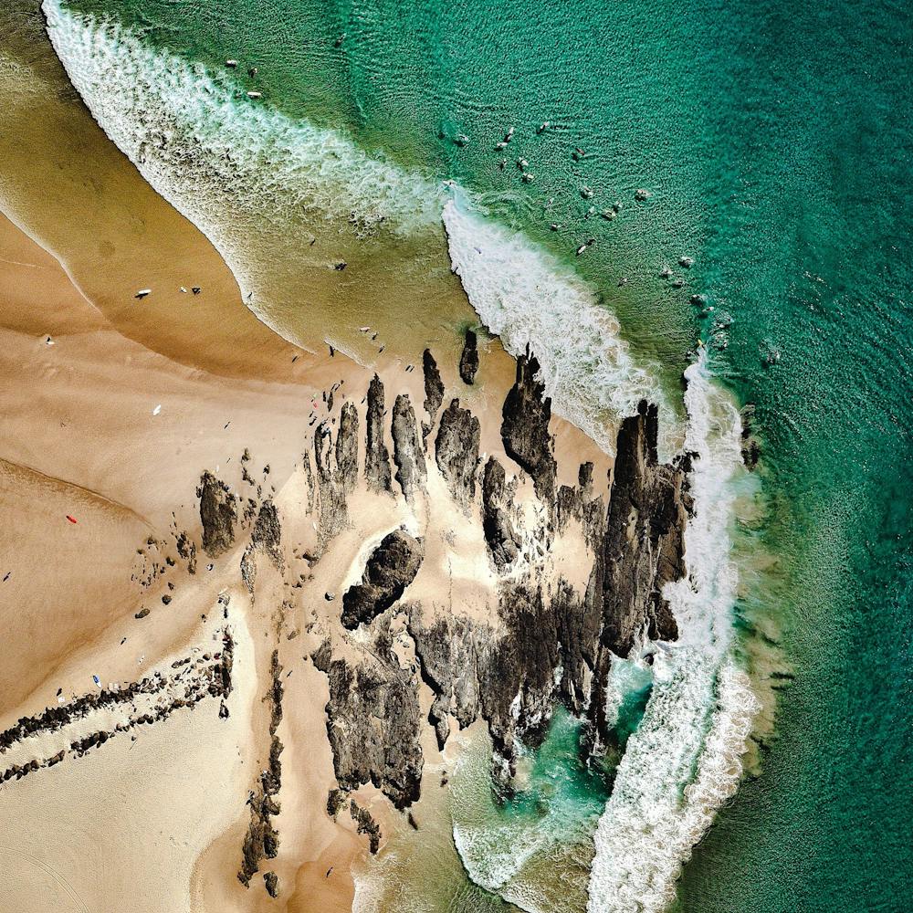
Golden Gate Bridge
37.819907°, -122.478558° - San Francisco, California, USAThe Golden Gate Bridge is a 1.7 mile long suspension bridge in San Francisco, California that spans the Golden Gate Strait, the mile-wide channel between San Francisco Bay and the Pacific Ocean. The bridge’s signature color, known as “international orange”, was selected to complement its natural surroundings and enhance its visibility in fog.
Nearmap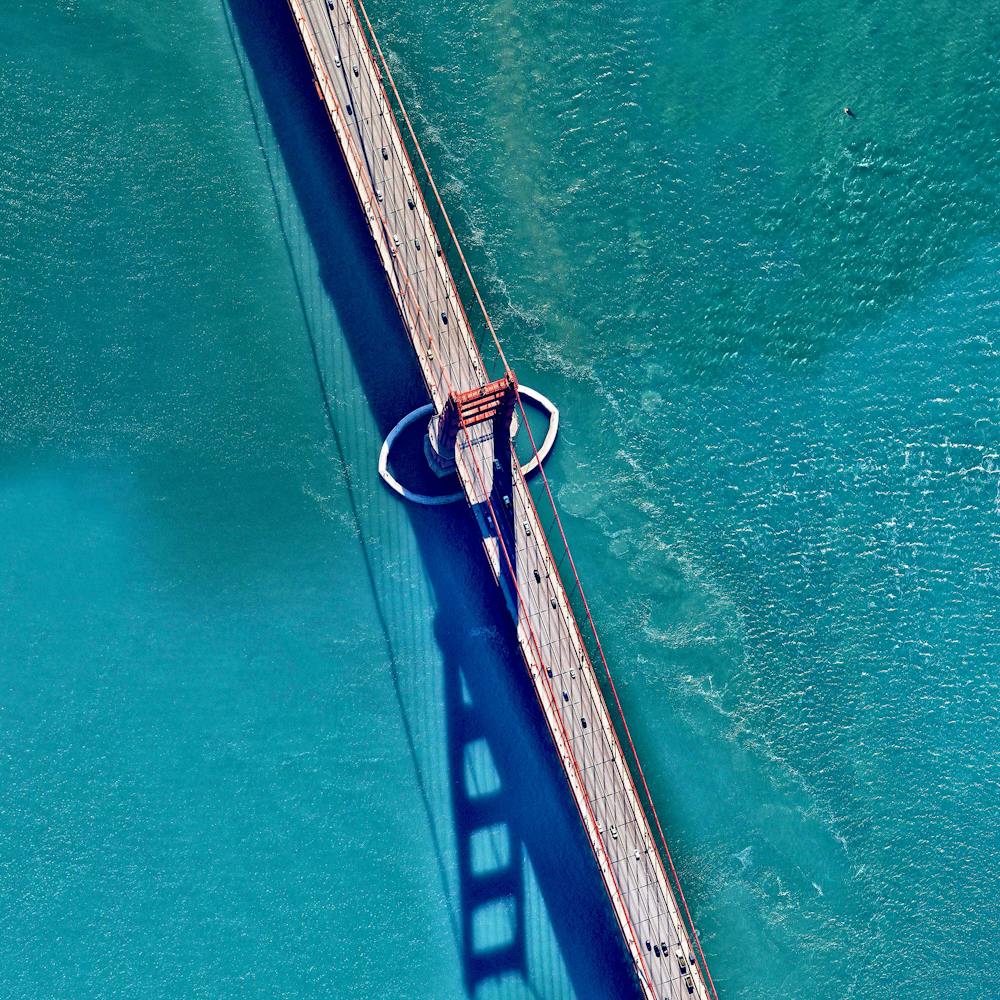
Grand Canyon
36.100000°, -112.100000° - Arizona, USAThe Grand Canyon is a steep-sided canyon carved by the Colorado River in the state of Arizona in the United States. The geological wonder is 277 miles (446 km) long, up to 18 miles (29 km) wide, and attains a depth of 6,093 feet (1,857 meters) at it’s deepest point. Recent studies suggest that the river established its course through the area roughly 5 or 6 million years ago and has continuously expanded the size of the canyon and exposed nearly two billion years of Earth's geological history since then.
Maxar Technologies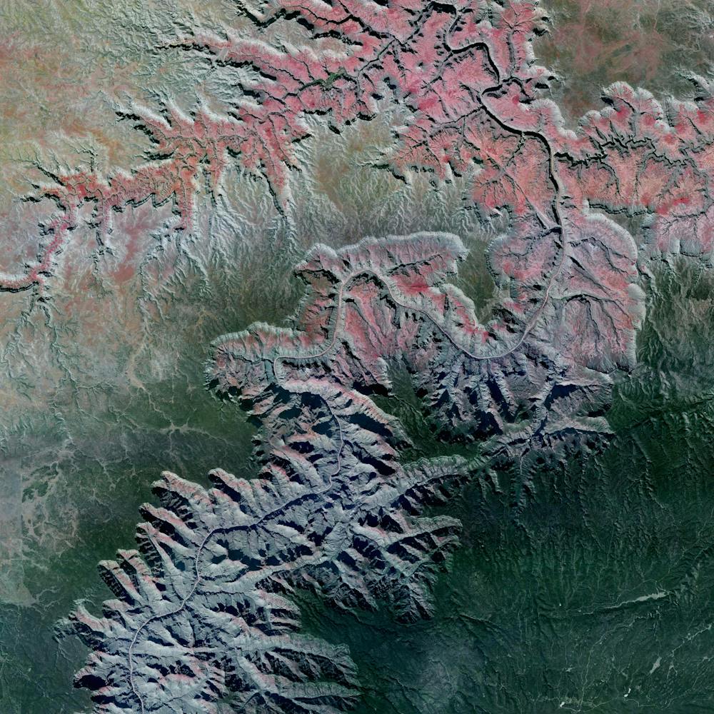
Grand Prismatic Spring
44.525000°, -110.838056° - Yellowstone National ParkYellowstone National Park was established on March 1, 1872. At the Grand Prismatic Spring, visitors can get a close-up view on a series of elevated boardwalks. The hot spring gets its vivid color from pigmented bacteria that grow around the edge of the mineral-rich water.
Maxar Technologies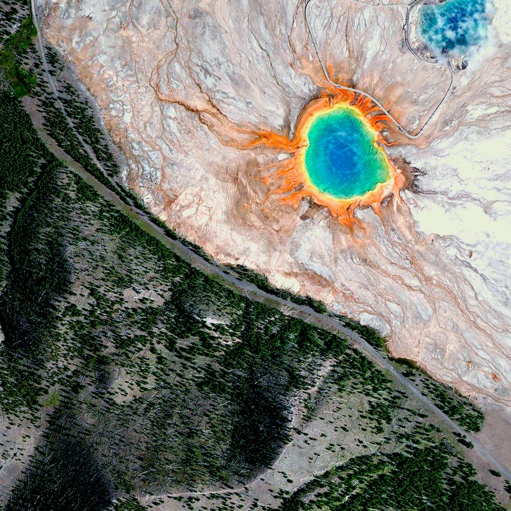
Grande Dixence Dam
46.080556°, 7.403889° - Hérémence, SwitzerlandThe Grande Dixence Dam in the canton of Valais in Switzerland is the tallest gravity dam in the world with a height of 935 feet (285 m). A gravity dam resists the horizontal thrust of the contained water, in this case the Dixence River, entirely by its own weight. The Grand Dixence took 14 years to construct, contains approximately six million cubic meters of concrete, and generates power for more than 400,000 Swiss homes.
Maxar Technologies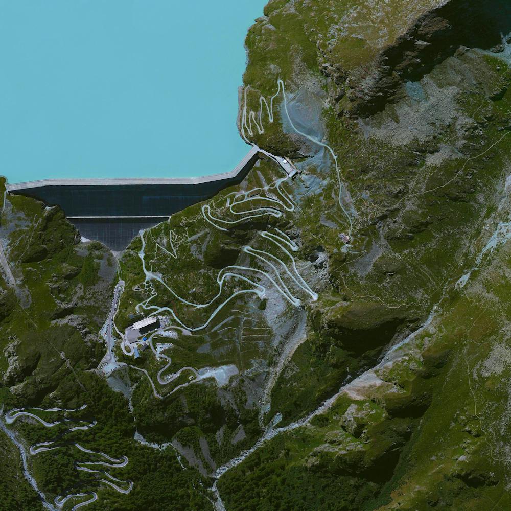
Great Bahama Bank
23.568444°, -76.440111° - BahamasThe Great Bahama Bank is a carbonate platform submerged in the shallow waters around Andros Island in the Bahamas. The limestone that makes up the Bank has been accumulating for at least 140 million years and today is more than 2.8 miles (4.5 km) thick. During the last ice ages, when sea level was roughly 390 feet (120 m) lower, the Great Bahama Bank was dry land.
Maxar Technologies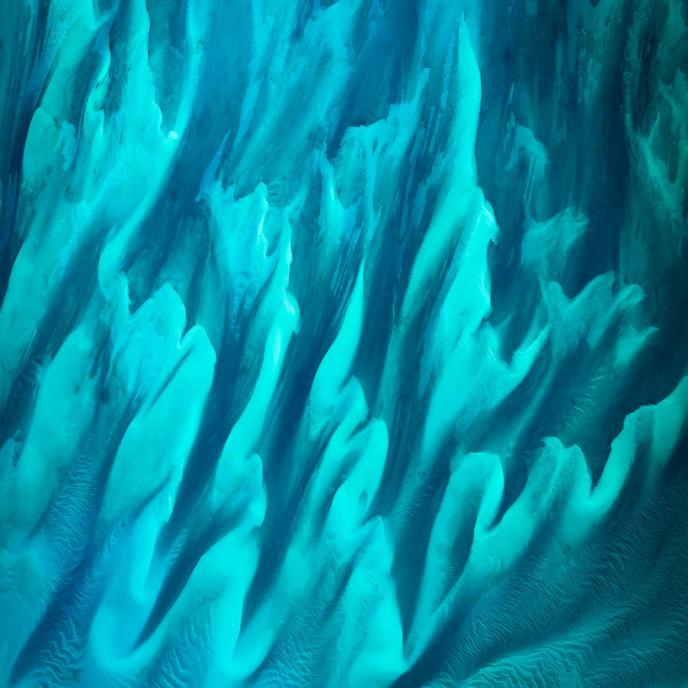
Great Exuma Island
23.118750°, -75.050306° - The BahamasSeveral cays extend off the western coast of Great Exuma Island in the Bahamas. Great Exuma is the largest of more than 365 islands in the Exuma district, with an area of 61 square miles (158 sq. km). The Tropic of Cancer, also known as the Northern Tropic, runs across a beach located on Great Exuma.
NASA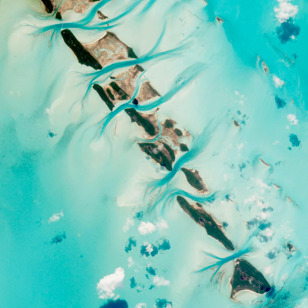
Great Pyramids of Giza
29.979234°, 31.134201° - Cairo, EgyptThe Great Pyramids of Giza are located on the outskirts of Cairo, Egypt. Dating back to 2580 BC, the Great Pyramid, the largest structure at the site, is the oldest of the Seven Wonders of the Ancient world and the only one to remain largely intact. With an estimated 2,300,000 stone blocks weighing from 2 to 30 tons each, the 481 foot pyramid was the tallest structure in the world for more than 3,800 years.
Maxar Technologies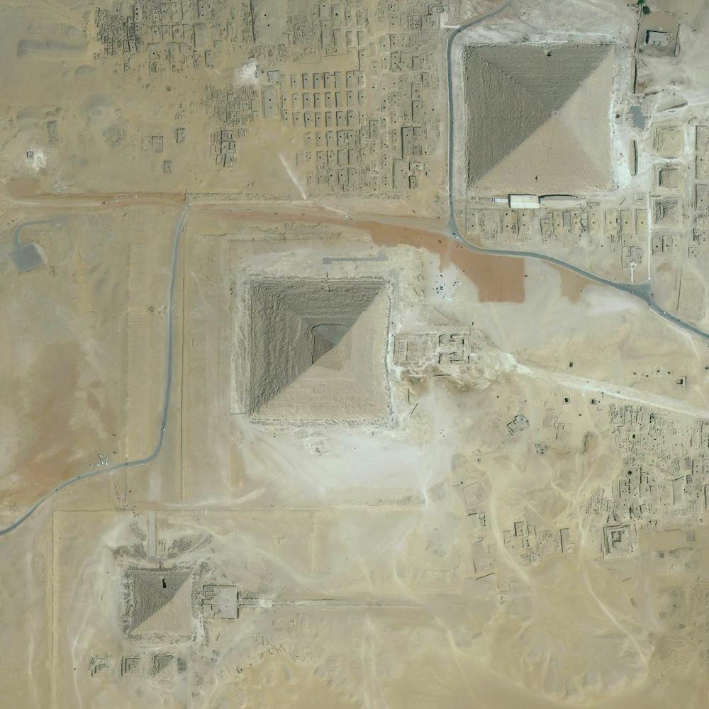
Great Salt Lake Evaporation Ponds
41.294750°, -112.258444° - Great Salt Lake, Utah, USAEvaporation ponds in the Great Salt Lake, Utah, are pictured in this Overview. The Great Salt Lake contributes an estimated $1.3 billion annually to Utah’s economy, including $1.1 billion from industry, which is mostly due to mineral extraction. Minerals extracted from the lake include sodium chloride, potassium sulfate, and magnesium-chloride.
Maxar Technologies