Daily
One regular dose of Earth from above
Monaco F1
43.738418°,7.424616° - Planet
The streets of Monte Carlo come alive today as the 2025 Monaco Grand Prix unfolds along one of the most iconic circuits in Formula 1. Winding through the harbor, past luxury yachts, and beneath historic architecture, this race has been a crown jewel of the sport since 1929. With overtaking nearly impossible, every qualifying lap, pit stop, and millisecond matters.
Lake Powell
37.068262°,-111.243311° - Maxar
Lake Powell is a man-made reservoir on the Colorado River, straddling the border between Utah and Arizona. Second in size only to Lake Mead, it can store up to 7.9 trillion gallons (29.9 trillion liters) of water when full. That’s almost 12 million Olympic-sized swimming pools.
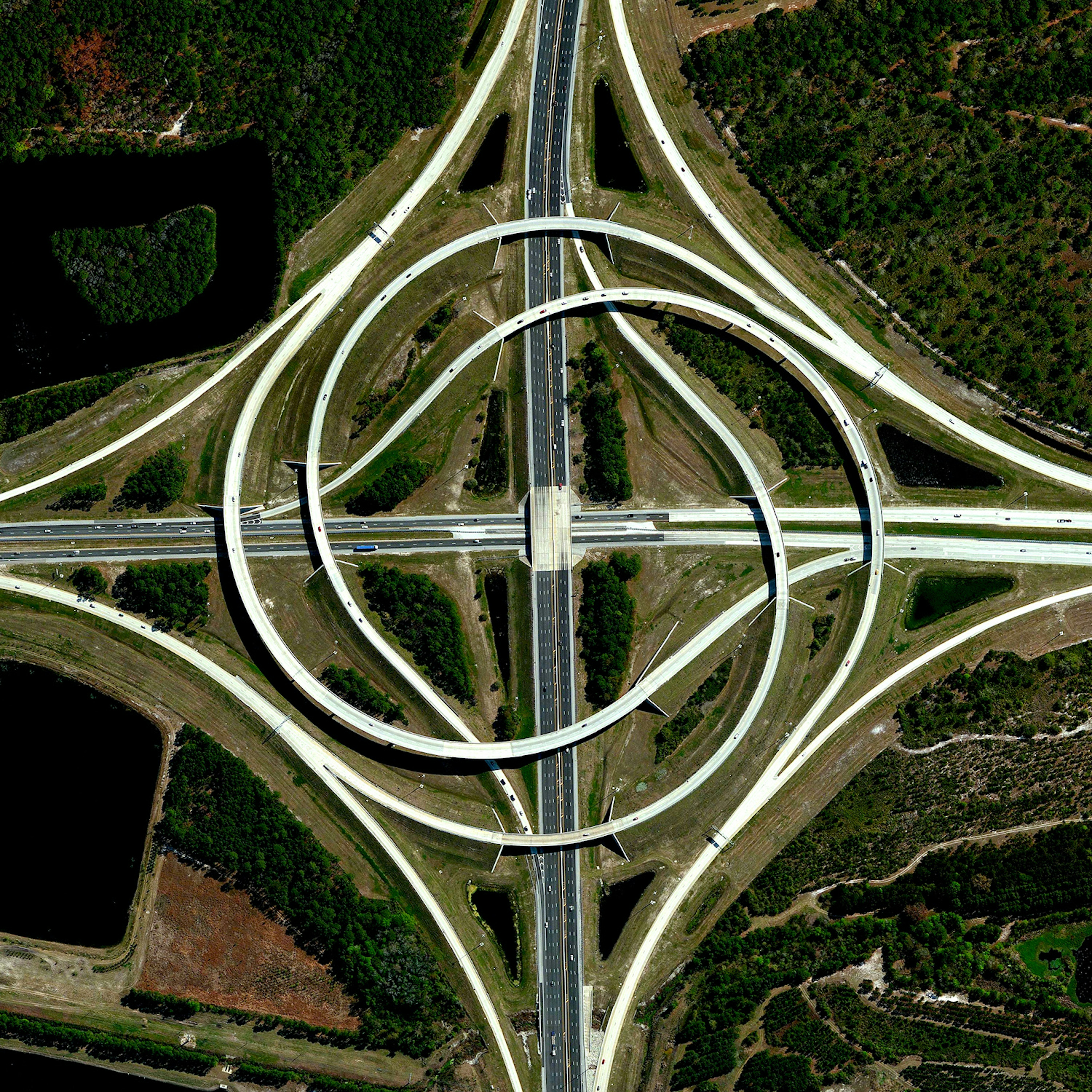
Jacksonville Turbine Interchange
30.253056°,-81.516194° - Maxar
A turbine interchange connects the SR 9A and SR 202 in Jacksonville, Florida, USA. Also known as a whirlpool or turbine interchange, this structure consists of left-turning ramps sweeping around a center interchange, thereby creating a spiral pattern of right-hand traffic. This type of junction is rarely built, due to the vast amount land that is required to construct the sweeping roads.
Manaus
-3.118813°,-60.021618° - Maxar
Manaus, Brazil, is a fast-growing city of 2 million people located along the Amazon River. Its population has doubled since 1990, causing urban development to sprawl into and alongside tracts of the Amazon rainforest — as seen in this Overview.
Monterrey, Mexico
25.665820°,-100.299560° - Maxar
Monterrey is one of the largest and fastest-growing cities in Mexico, with more than 5.3 million residents. Its population has more than doubled in the last 40 years, causing the city to sprawl alongside and outward from the rugged, folding mountain ranges of adjacent Cumbres de Monterrey National Park.
Sakurajima Volcano
31.579415°,130.659530° - Maxar
Sakurajima, an active stratovolcano in Kyushu, Japan, was once an island until lava flows from its massive 1914 eruption connected it to the Osumi Peninsula (seen at left in this Overview). Since 1955, it has been in a near-constant state of eruption, producing thousands of small explosions each year. Just 8 km (5 mi) away, the city of Kagoshima—home to more than 600,000 people—is one of the largest urban centers in such close proximity to an active volcano.
Genoa
44.407855°,8.919063° - Maxar
Genoa, Italy, is a bustling maritime city of over 580,000 inhabitants on the Mediterranean Sea. Its intricate urban layout, built on hills and a rugged coastline, blends medieval alleyways, Renaissance palaces and modern architecture. The Port of Genoa has been one of the busiest and most significant Mediterranean seaports for hundreds of years.
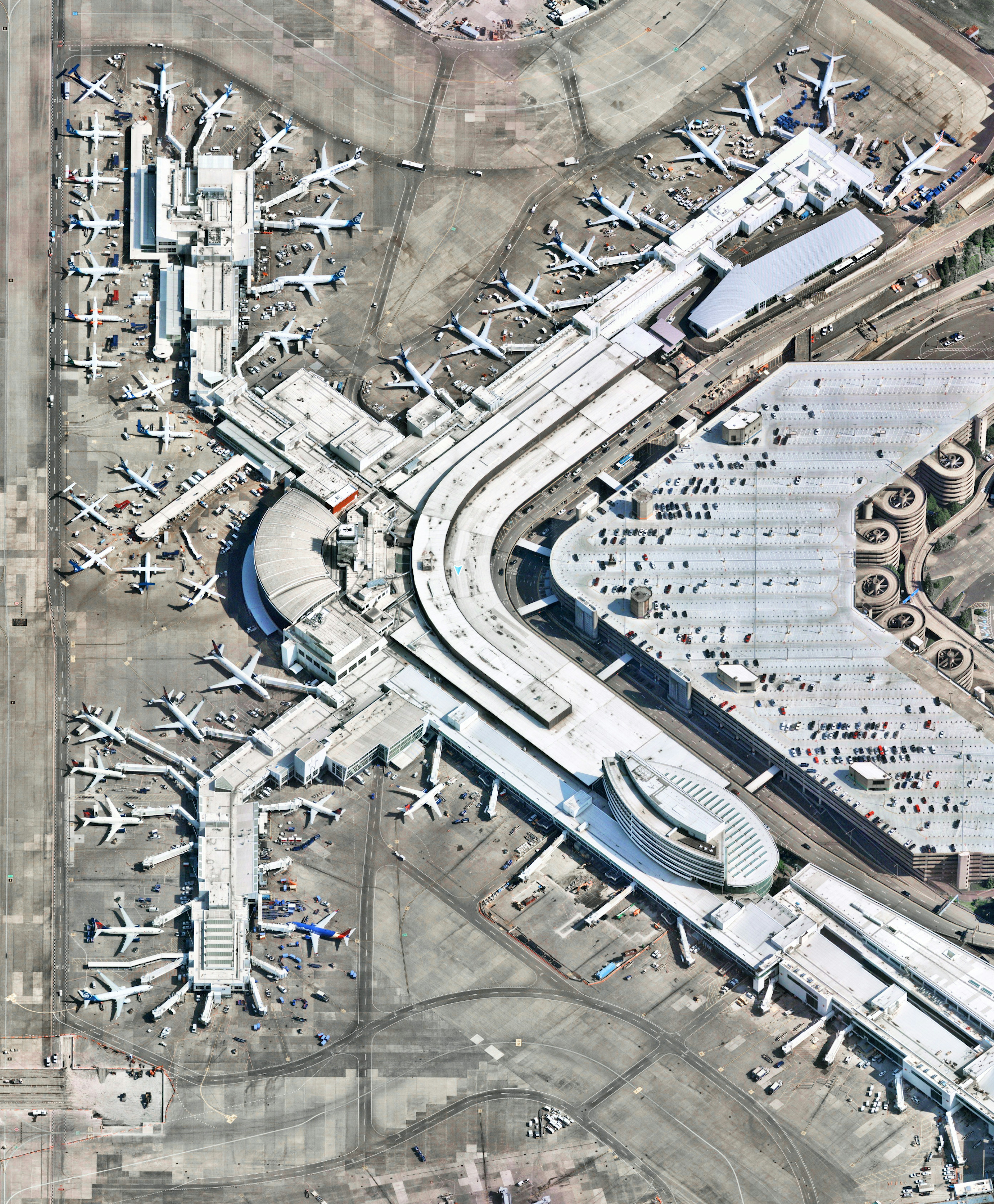
Sea-Tac Airport
47.448889°,-122.309444° - Nearmap
Seattle–Tacoma International Airport, also known as Sea–Tac, is the primary commercial airport serving the metropolitan area of Seattle, Washington. It is one of the busiest airports in the U.S. and in 2024 served an all-time record 52.6 million passengers. This Overview shows the airport’s central terminal, which contains most of its 103 gates.
Mount Fuji from Space
35.362457°,138.730426° - NASA
Mount Fuji, Japan, as seen from the International Space Station. An active stratovolcano and the tallest peak in Japan at 12,389 feet (3,776 m), Fuji has an extremely symmetrical cone that is snow‑capped for several months of the year. During warmer months, climbing routes make it possible for hundreds of thousands of people to hike the summit each year.
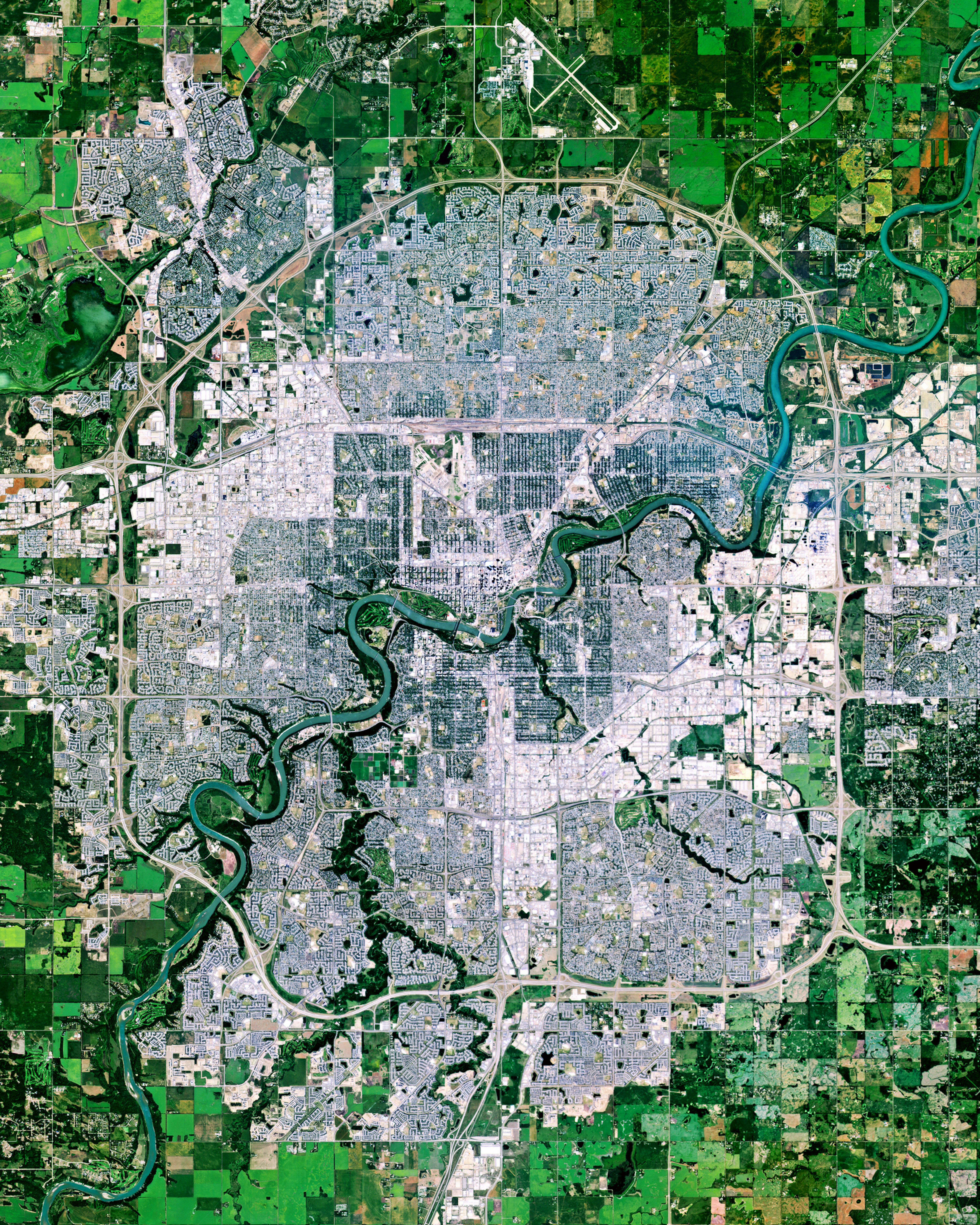
Edmonton
53.534444°,-113.490278° - Planet
Edmonton is the capital city of the Canadian province of Alberta. It straddles the North Saskatchewan River and serves as a staging point for large-scale oil sands projects in the northern part of the province, as well as large-scale diamond mining operations in the Northwest Territories. Edmonton is home to about 1.5 million people — the northernmost city on the continent with a population over one million.
Akimiski Island
53.000000°,-81.333333° - Maxar
Akimiski Island is the largest island in James Bay (a southeasterly extension of Hudson Bay), Canada. Most of the vegetation covering the island consists of lichen, moss, sedges and black dwarf spruce, giving it a vibrant color scheme from the aerial perspective. The island has no year-round human inhabitants; however, it is home to the 1,300-square-mile (3,367-sq-km) Akimiski Island Migratory Bird Sanctuary.
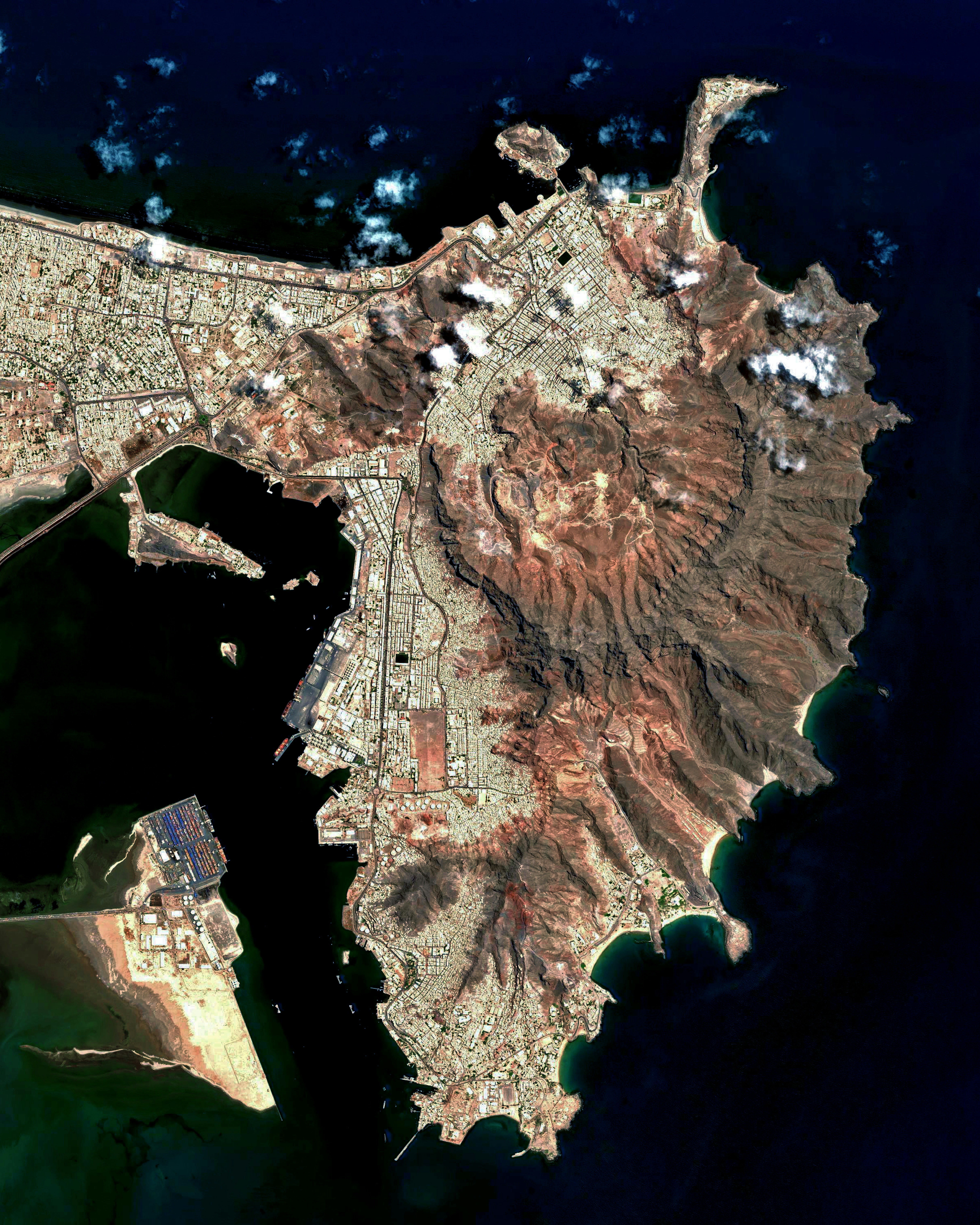
Aden
12.800000°,45.033333° - Airbus Space
Aden is one of the most populous cities in Yemen, with more than 1 million residents. Its natural harbor lies in the crater of a dormant volcano, which now forms a peninsula joined to the mainland by a low isthmus. The city is situated on the eponymous Gulf of Aden, near the eastern approach to the Red Sea.
Krenitsyna Volcano
50.177184°,155.403244° - NASA
The peak of Krenitsyna Volcano rises as an island within an island in Russia's Far East. It is located on Onekotan Island in the northwest Pacific Ocean and surrounded by Kol'tsevoye Lake, a 4.6-mile-wide (7.5-km) caldera lake. Onekotan is part of the Kuril Islands, a volcanic archipelago and segment of the “Ring of Fire” — a path of tectonic activity that circles the Pacific Ocean.
Adelaide
-34.927500°,138.600000° - Maxar
Adelaide is the capital and largest city of South Australia, with around 1.4 million inhabitants. Founded in 1836 as a planned capital, its design features a city center in a grid layout, interspaced by wide boulevards and large public squares, and entirely surrounded by parklands. The River Torrens can be seen flowing through the middle of the city in the Overview.
Fish River Canyon
-27.595129°,17.612021° - Maxar
Fish River Canyon, in southern Namibia, is the largest canyon in Africa. It features a gigantic ravine that is about 100 miles (160 km) long, up to 17 miles (27 km) wide, and almost 1,800 feet (550 m) deep in certain places. The Fish River — the longest in Namibia — flows intermittently, usually flooding in late summer; the rest of the year it becomes a chain of long narrow pools.
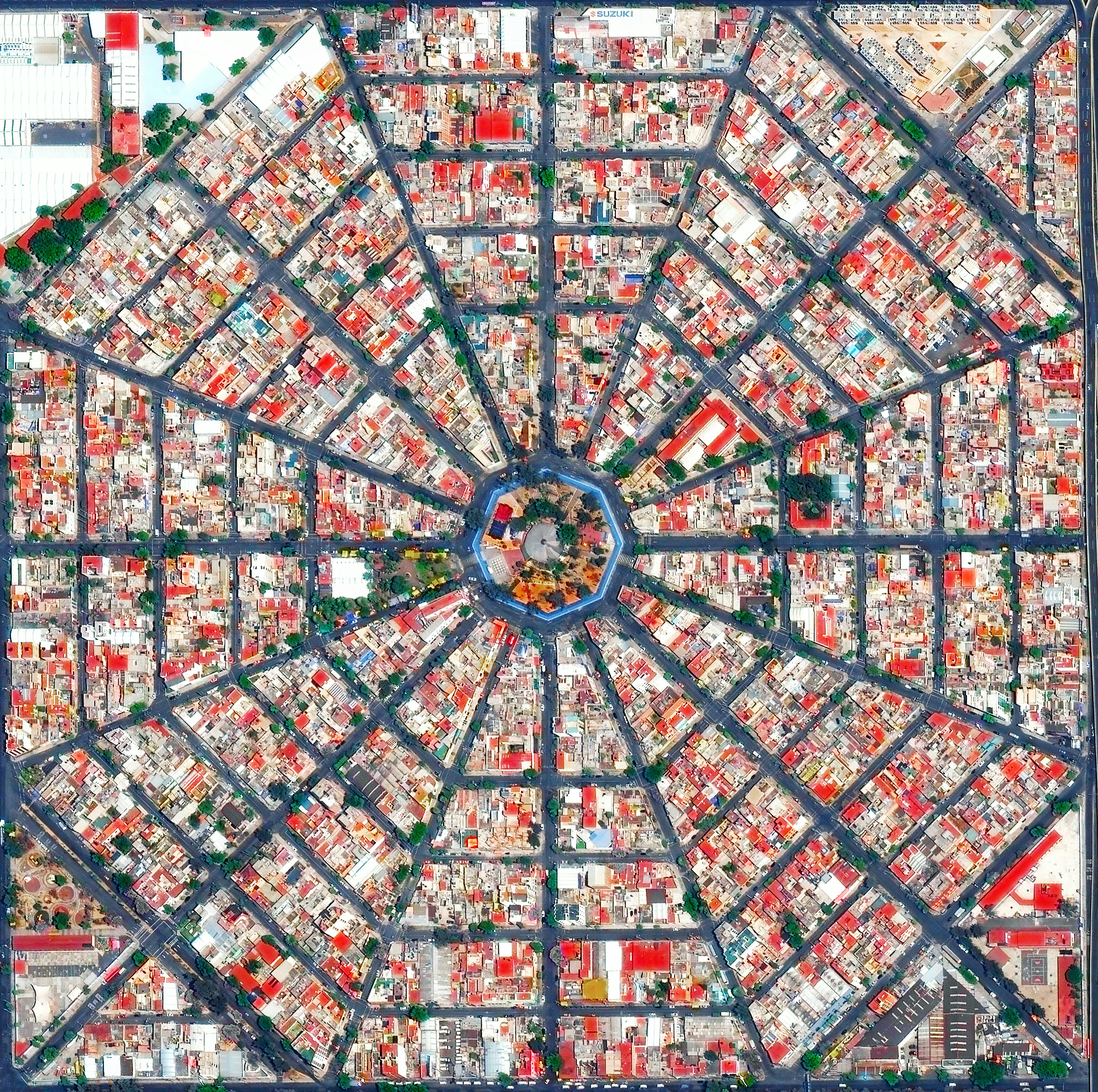
Plaza Del Ejecutivo
19.419889°,-99.088028° - Maxar
Radiating streets surround the Plaza Del Ejecutivo in the Venustiano Carranza district of Mexico City, Mexico. This district — which is home to more than 440,000 people — contains three of Mexico City’s large traditional markets: La Merced, Mercado de Sonora, and Mercado Jamaica.
Taiwan
25.066620°,121.516677° - ESA
Taiwan is a country in East Asia, located roughly 100 miles (160 km) from the coast of south-east China. Its main island, also known as Formosa, is mountainous to the east and highly urbanized and populated to the west. With about 24 million inhabitants across 13,974 miles (36,193 sq. km), Taiwan is among the most densely populated countries on Earth.
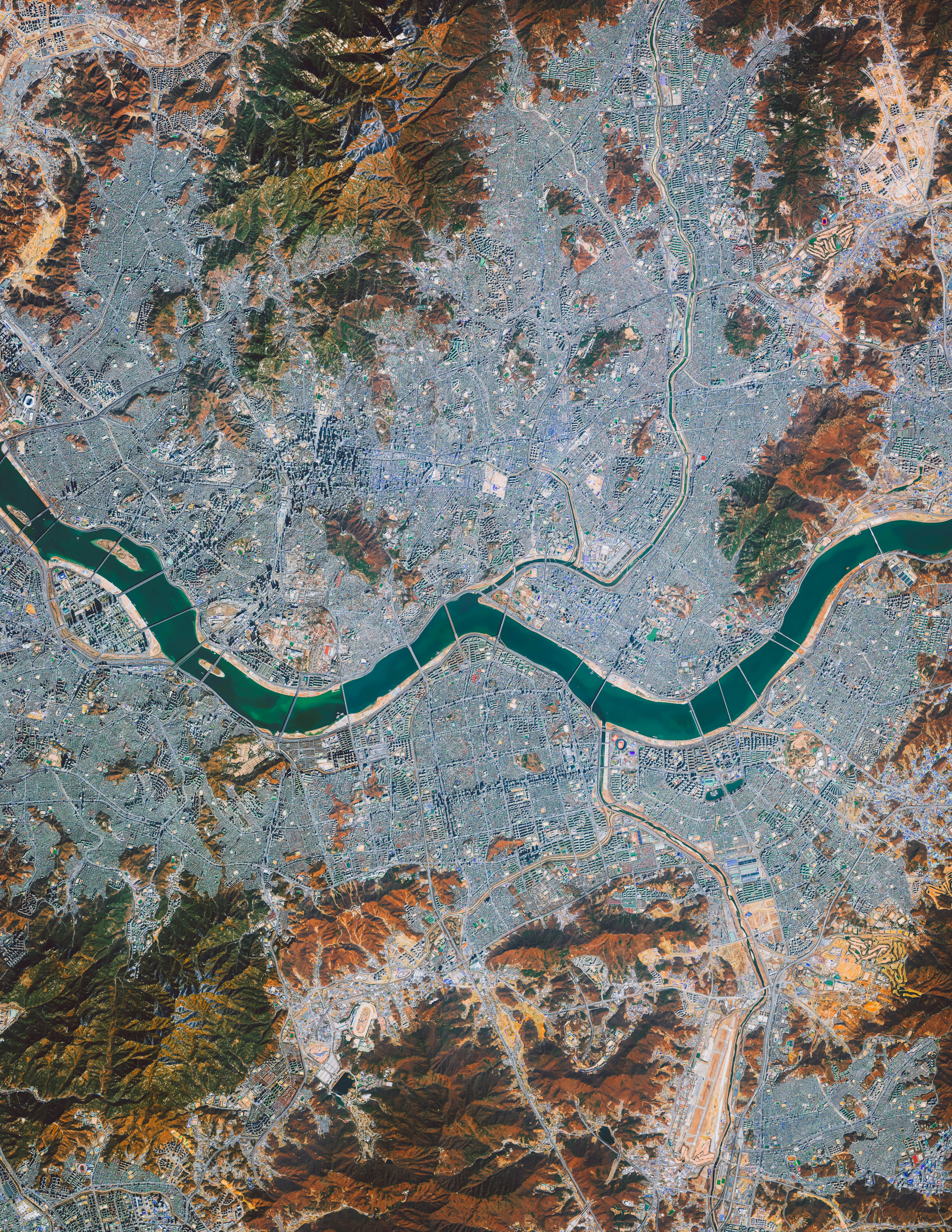
Seoul
37.566667°,126.966667° - Maxar
Seoul is the capital and largest metropolis of South Korea, with more than 25 million residents in its metropolitan area. Strategically situated on the Han River, Seoul’s history can be traced back more than 2,000 years to 18 BC, when it was founded by members of the Baekje Kingdom. In recent years, the city has experienced massive economic growth and is one of the top 10 wealthiest cities in the world with a GDP of nearly $900 billion (USD).
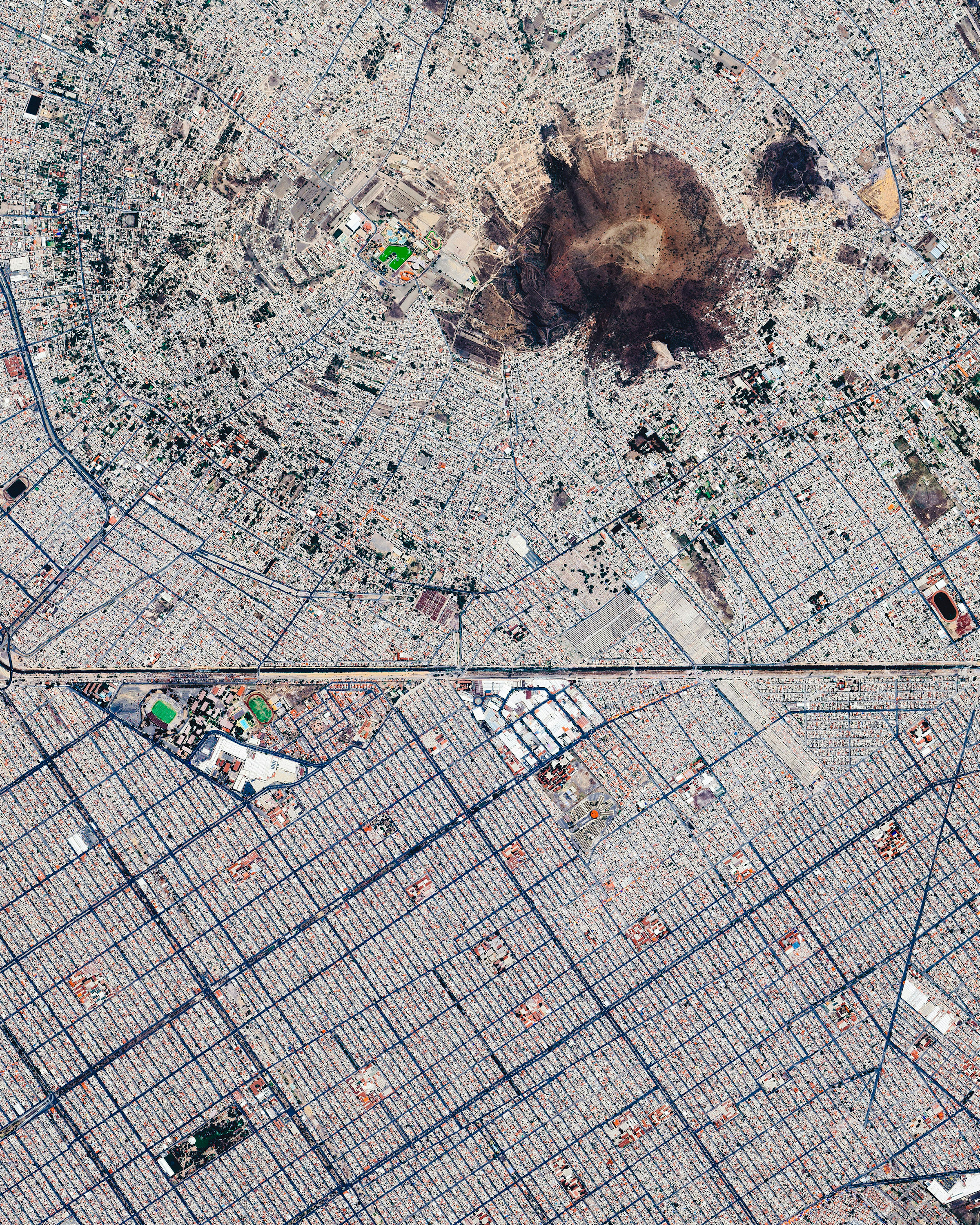
Chimalhuacán and Nezahualcóyotl
19.395475°,-98.978875° - Maxar
Chimalhuacán (top) and Ciudad Nezahualcóyotl are two municipalities in Greater Mexico City, with a combined population of nearly 1.8 million. Nezahualcóyotl is characterized by its long, straight, and gridded streets, while Chimalhuacán is arranged in a mostly radial pattern around the slopes of Cerro Chimalhuache. The two are separated by a canal of the Río de la Compañía.
Gulf of Mexico Name Change
25.304304°,-90.065918° - NASA
The Gulf of Mexico has been renamed The Gulf of America for Google Maps users inside the United States. The name change stems from an executive order signed by President Donald Trump on his first day in office, which directs U.S. authorities to make the change to official maps. Users in Mexico will continue seeing Gulf of Mexico, while people in the rest of the world will see both names.


