Overview Index
Adelaide Canola Flowers
-34.439861°, 138.557833° - Adelaide, AustraliaYellow canola fields are visible across the landscape north of Adelaide, Australia. While various crops are grown here, the canola fields are easy to notice because of their vibrant flowering color. The crop is grown for the production of oil, which is extracted by slightly heating and then crushing the flower seeds. Canola oil is primarily used as a source of biodiesel and also for cooking purposes.
Nearmap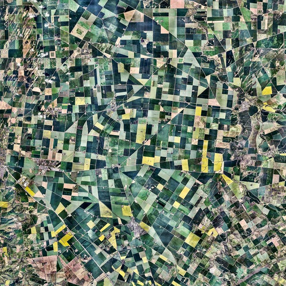
Adelaide Rift Complex
-29.791018°, 137.823069° - Flinders Ranges, South AustraliaRock formations of the Adelaide Rift Complex are visible in the South Australian Outback. The swirling patterns are composed of folded and faulted sediments that were deposited there in a large basin more than 540 million years ago. Since then, the land folded and faulted to become a large mountain range and then underwent extensive erosion to become the relatively low ranges that we see today. For a sense of scale, this Overview is approximately 100 square miles.
Maxar Technologies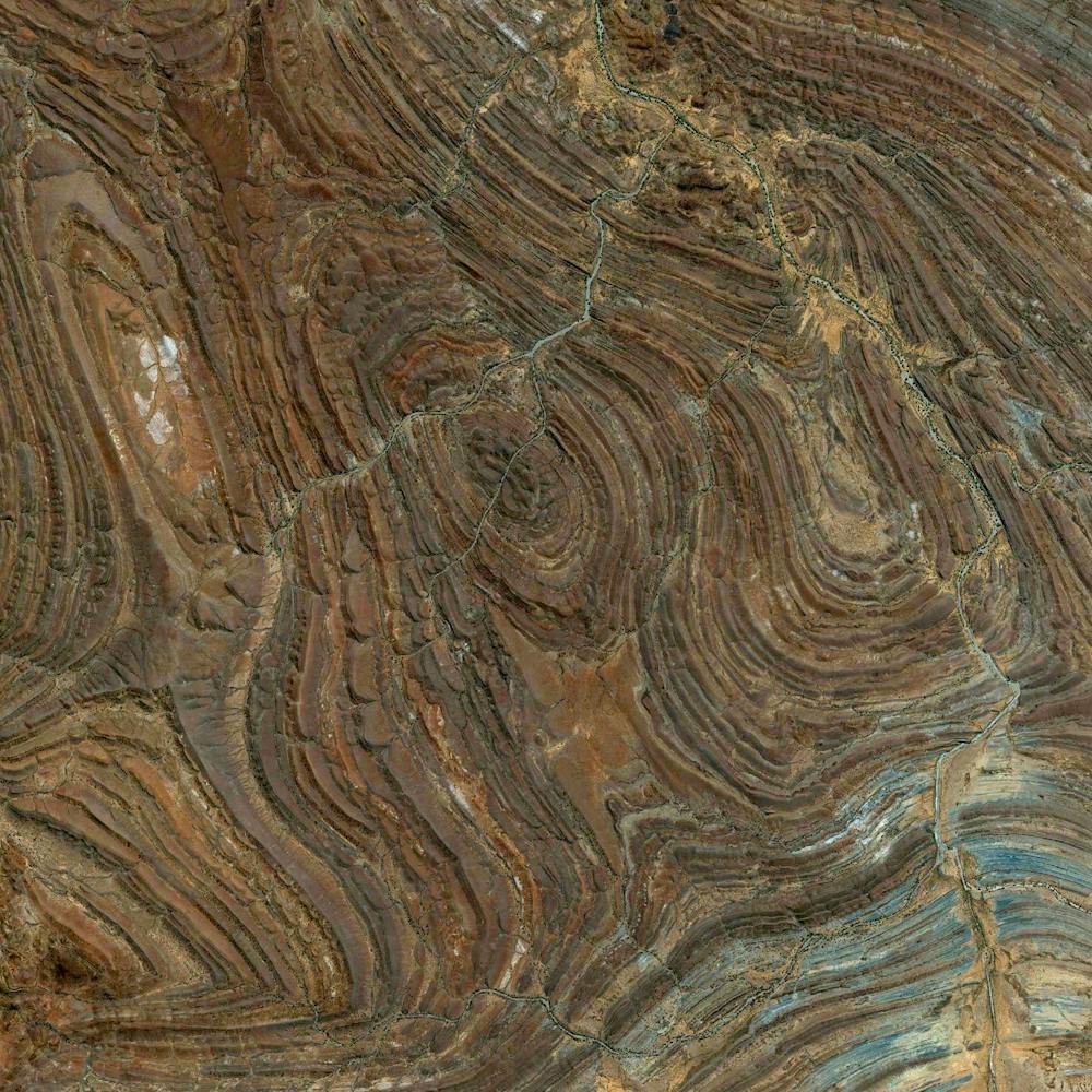
Adriatic Tankers
45.315253°, 12.071250° - Venice, ItalyMassive oil tankers are dwarfed by the Adriatic Sea just outside the Port of Venice, Italy. Last year, 26.4 million tons of freight passed through the port — an increase of more than 1 million tons from 2017. Of this, at least 7.7 million tons was refined petroleum products, and much of the rest was dry bulk goods and containerized cargo.
Maxar Technologies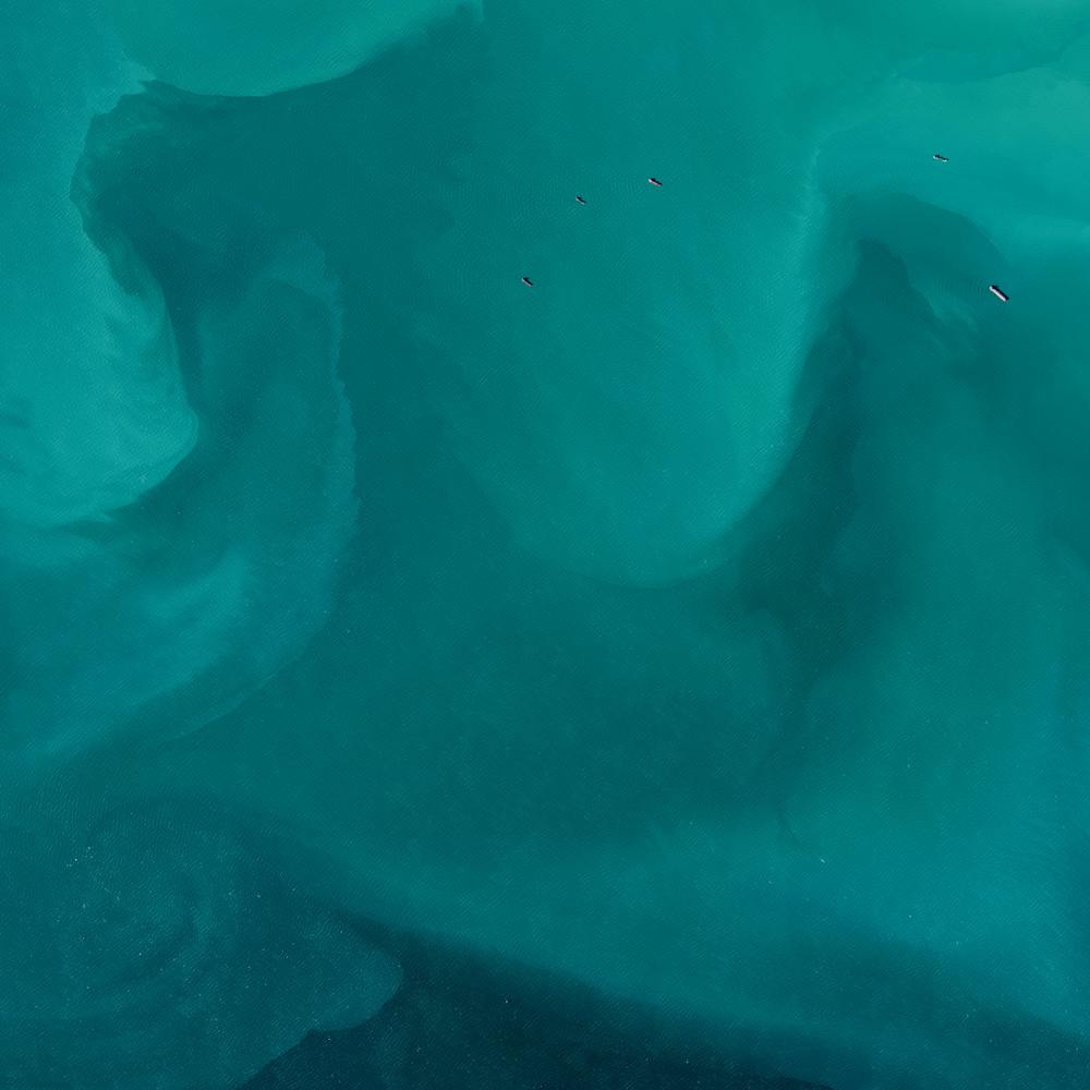
Adventuredome
36.138056°, -115.167389° - Las Vegas, Nevada, USAAdventuredome is a five-acre indoor amusement park on the Las Vegas Strip in Nevada, USA. The facility's main structure consists of more than 350,000 square feet of pink insulated glass. Inside are two roller coasters, a water ride, rock climbing wall, 18-hole miniature golf course and dozens of carnival games.
Nearmap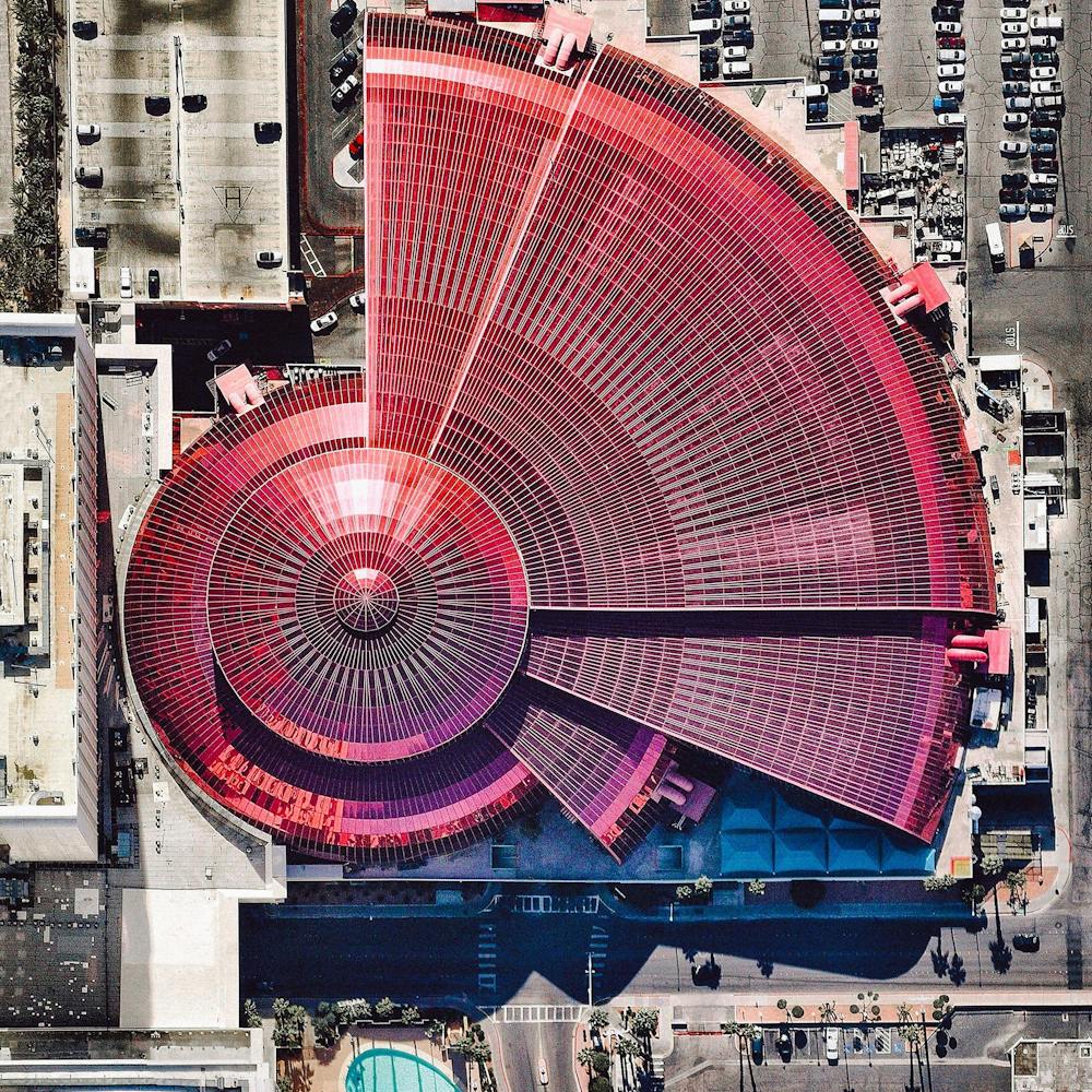
Agricultural development
37.194722°, -4.046389° - Huétor-Tájar, Granada, SpainAgricultural development surrounds Huétor Tájar, a small town located in the province of Granada, Spain. The primary crops grown in the municipality are asparagus and olives.
Maxar Technologies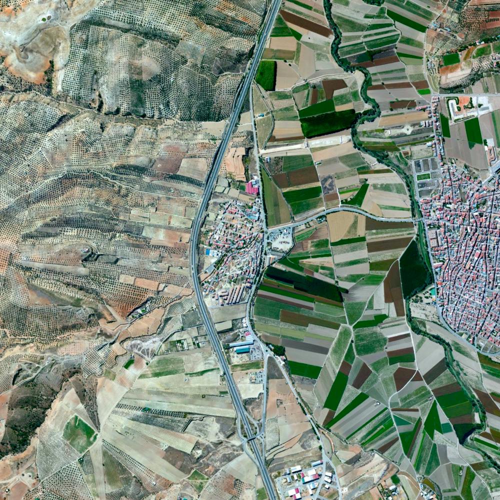
Agricultural Development
30.122943°, 31.133676° - Ausim / Shinbari, EgyptAgricultural development encircles the towns of Ausim and Shinbari in the Cairo Governorate of Egypt. The towns are located within the fertile area surrounding the Nile River, the country’s main source of water because it has no effective rainfall. The roughly 55 billion cubic meters of water that are used from the river each year represents more than three quarters of the country’s resources for usable water.
Maxar Technologies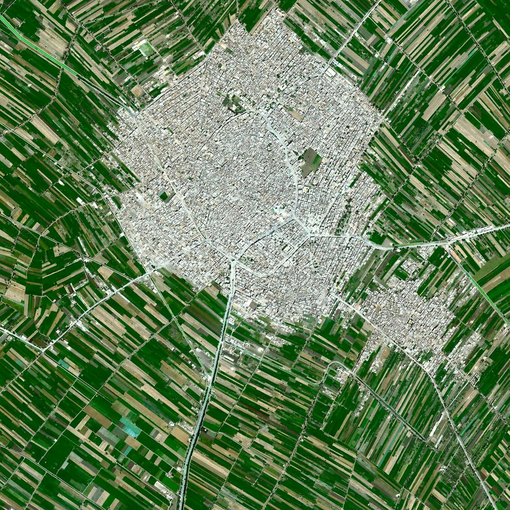
Agricultural Development
38.925233°, -121.714577° - Meridian, California, USAAgricultural development in Meridian, California is partitioned by irrigation canals that originate at the Sacramento River. On average, 9.6 million acres of cropland across the state are irrigated with 11 trillion gallons of water every year. As of 2014, farmers in California cultivated approximately half of the United State’s fruits, vegetables, and nuts.
Maxar Technologies
Agriculture development
45.465429°, 43.612853° - Stavrapol Krai, RussiaAgricultural development in Stavrapol Krai, Russia is made possible with water that travels down from the Caucasus Mountains. The region’s temperate climate supports grape and grain crops.
Planet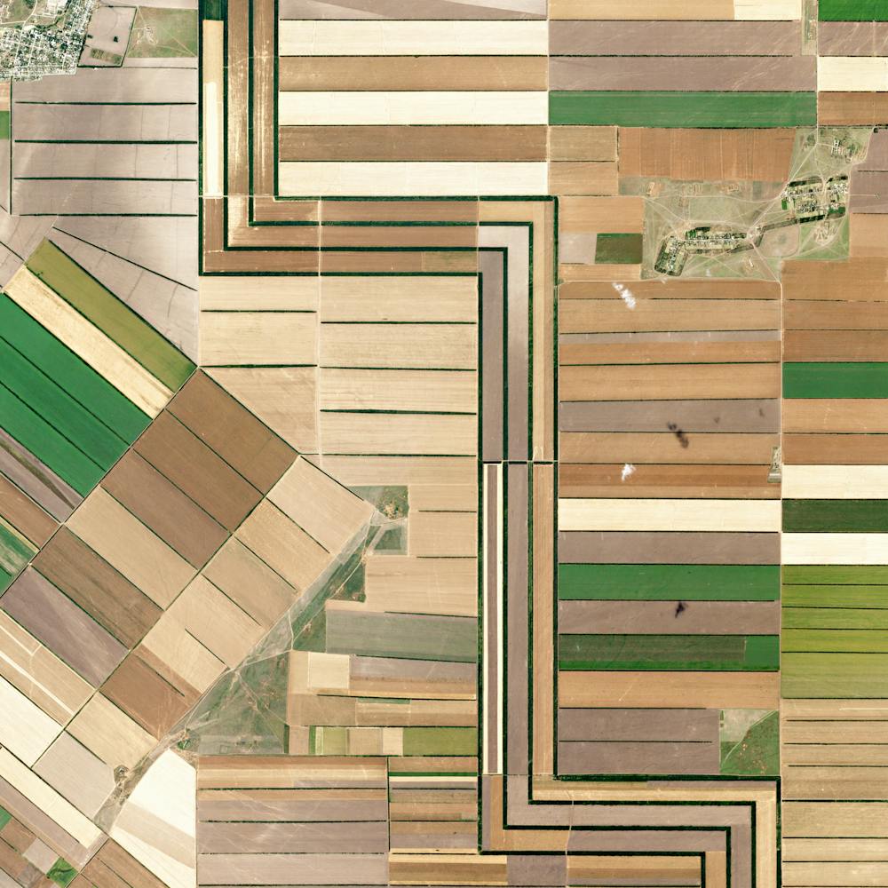
Akimiski Island
53.000000°, -81.333333° - 53.000000°, -81.333333°Akimiski Island is the largest island in James Bay (a southeasterly extension of Hudson Bay), Canada. Most of the vegetation covering the island consists of lichen, moss, sedges and black dwarf spruce, giving it a vibrant color scheme from the aerial perspective. The island has no year-round human inhabitants; however, it is home to the 1,300-square-mile (3,367-sq-km) Akimiski Island Migratory Bird Sanctuary.
Maxar Technologies
Al Falah Housing Project
24.445187°, 54.719998° - Abu Dhabi, United Arab EmiratesThe Al Falah Housing Project is located in Abu Dhabi, United Arab Emirates. The development covers 12.5 million square meters with 4,857 villas as well as mosques, schools, a shopping mall, and a hospital.
Maxar Technologies
Alabama Tornadoes
32.477972°, -85.367750° - Lee County, AlabamaHave a look at these Overviews to see the destruction caused by four tornadoes that tore through Lee County, Alabama, on Sunday. Latest news reports say 23 people were killed in the disaster and nearly 80 more were injured. Many trees, homes and other structures were destroyed. According to the National Weather Service, these tornadoes were among a group of 34 that struck Alabama, Florida, Georgia and South Carolina over the weekend — with one in Lee County reaching wind speeds of 170 mph (273 km/h).
Maxar Technologies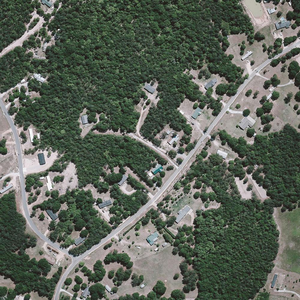
Alakol Lake
46.104867°, 81.178937° - KazakhstanAlakol Lake is a 1,020-square-mile (2,650 sq. km) salt lake located in east central Kazakhstan. The lake, which aptly translates to "multicolored lake," has varying shades of blue and green depending on its depth, levels of phytoplankton, and sediments flowing in from rivers and streams. Its mineral-rich water and mud are believed to be therapeutic, attracting many visitors who seek a natural remedy for psoriasis and other skin ailments.
Maxar Technologies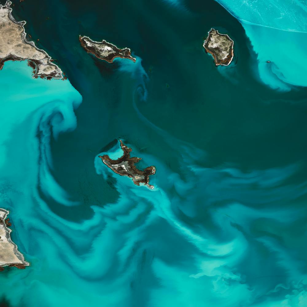
Albenga
44.049985°, 8.216569° - Albenga, ItalyAlbenga is a city situated on the Gulf of Genoa in Italy. The economy of Albenga is primarily driven by tourism, local commerce, and agriculture. When viewing the town from above, it’s easy to see the amount of space dedicated to agriculture because of the widespread use of greenhouses or "plasticulture." The use of plastic covering is designed to increase produce yield, increase produce size, and shorten growth time.
Maxar Technologies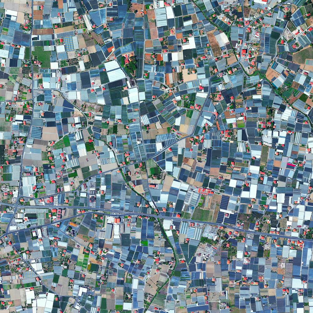
Albuquerque Baseball Complex
35.095083°, -106.763639° - Alburquerque, New Mexico, USAThe Albuquerque Baseball Complex is part of an 81-acre, city-owned sports complex in the Westland North community of Albuquerque, New Mexico. Its five fully lit turfed fields provide space for local baseball and softball teams to practice and play, and grandstand seating allows the facility to host regional and national tournaments. Next June, this sports complex will host the National Senior Games, a 20-sport biennial competition for men and women ages 50 and older.
Nearmap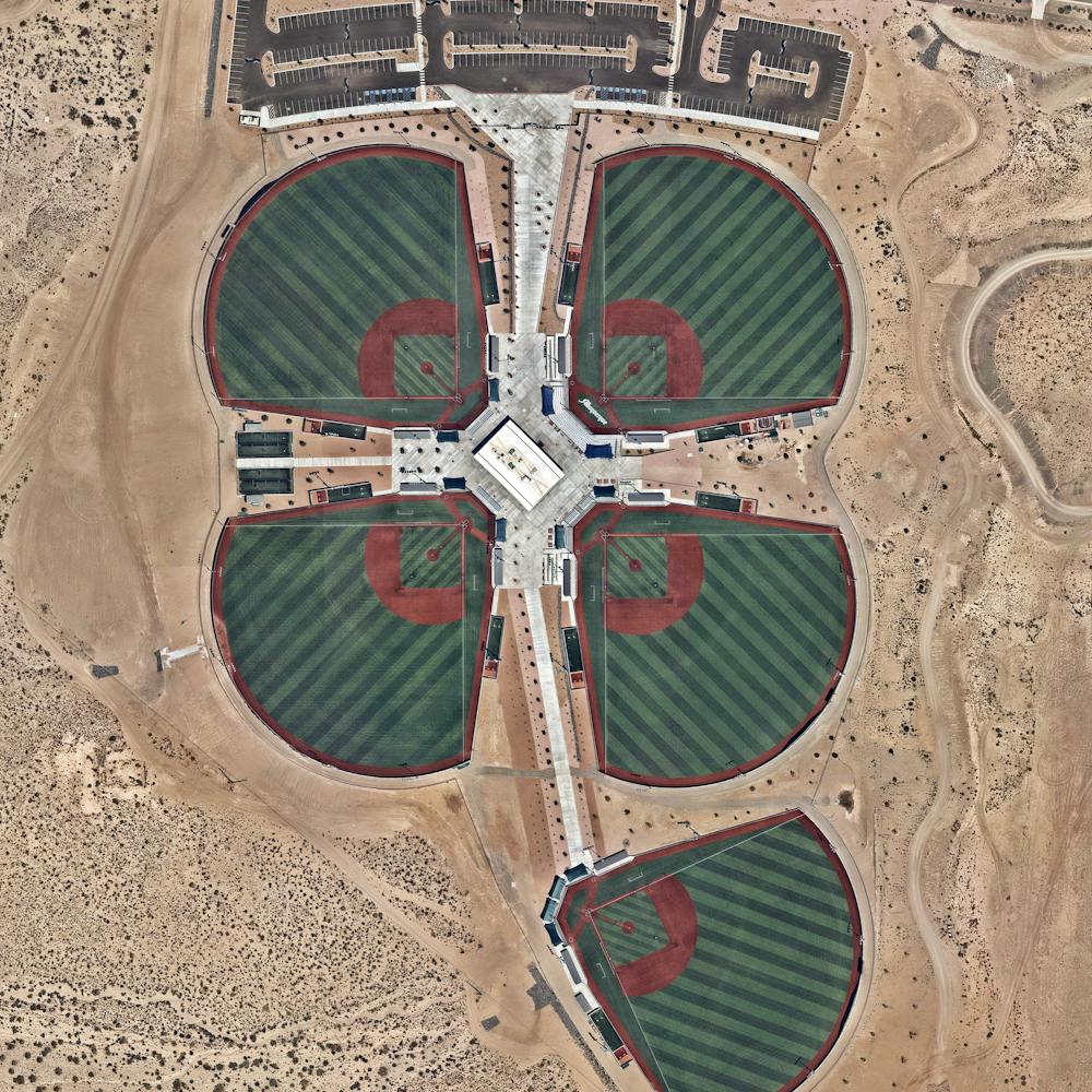
Alta Wind Energy Center
35.021111°, -118.320556° - Tehachapi Mountains, CaliforniaLocated in the Tehachapi Mountains of California, the Alta Wind Energy Center is the largest wind farm in the US, and third largest onshore farm in the world. The facility plans to reduce carbon dioxide emission by more then 5.2 million metric tons over the next 25 years, which is roughly the same as eliminating 446,000 cars off the road.
Maxar Technologies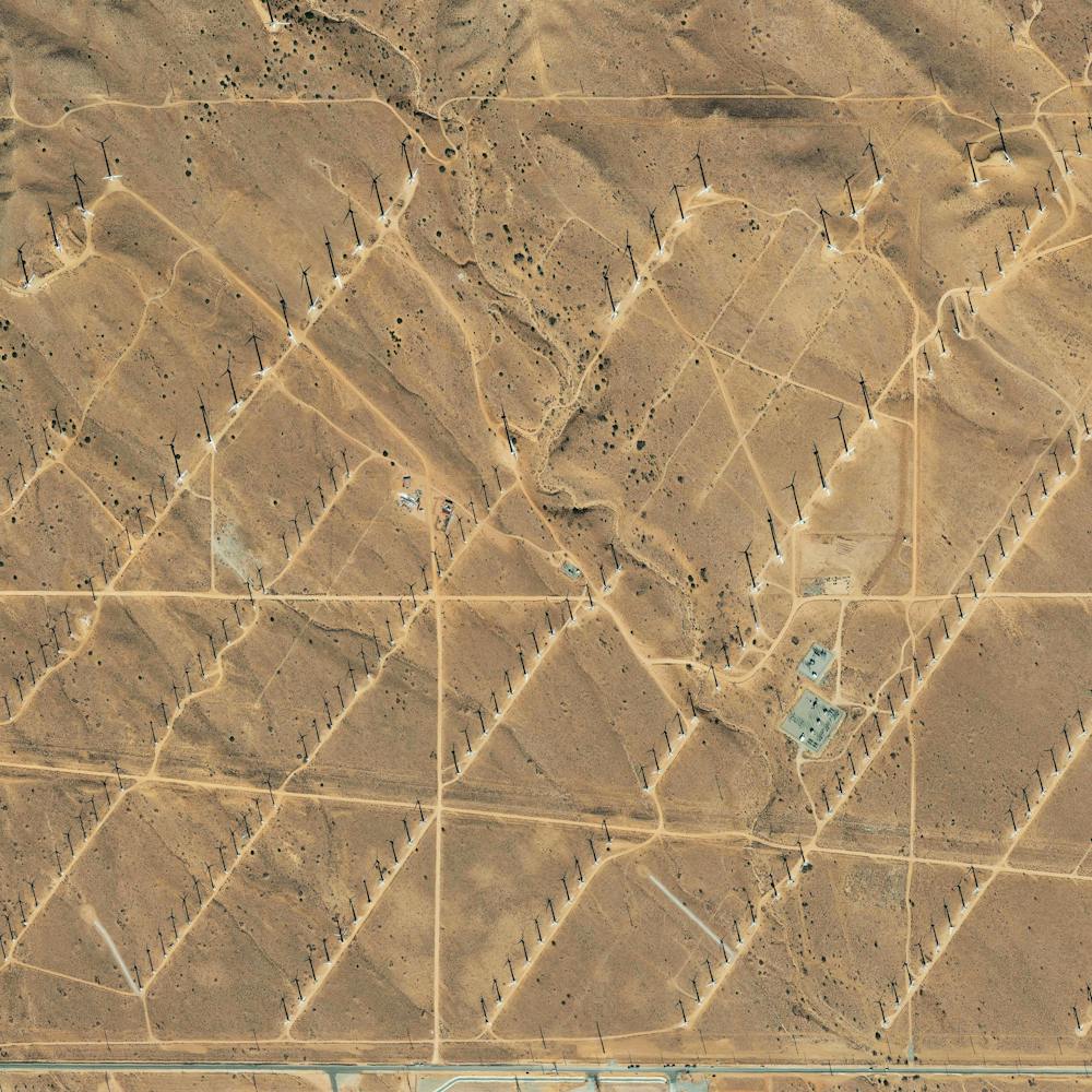
Altocumulus clouds
37.300000°, 62.350000° - Yolöten, TurkmenistanAltocumulus clouds - characterized by their patchy dispersal and elevation above 6,500 feet - pass over Yolöten, Turkmenistan. The town is located on the Murgab River and has a population of 37,000.
Maxar Technologies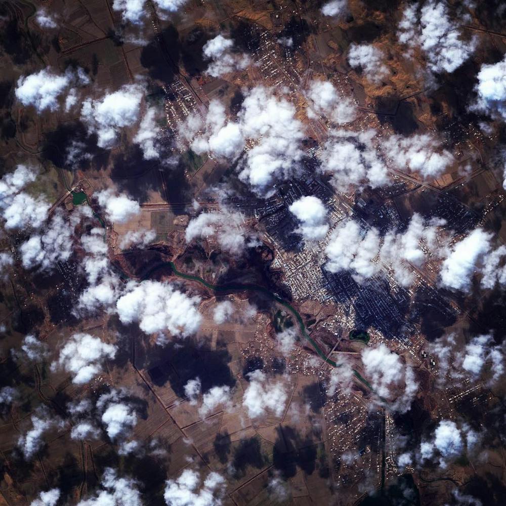
Amsterdam
52.366667°, 4.900000° - Amsterdam, NetherlandsThis Overview details the canal system of Amsterdam -- known as “Grachten.” In the early 17th century, when immigration was at a peak, a comprehensive plan for the city’s expansion was developed with four concentric half-circles of canals emerging at the main waterfront (seen on the right-hand side of this Overview). In the centuries since, the canals have been used for defense, water management, and transport. They remain a hallmark of the city to this day.
Maxar Technologies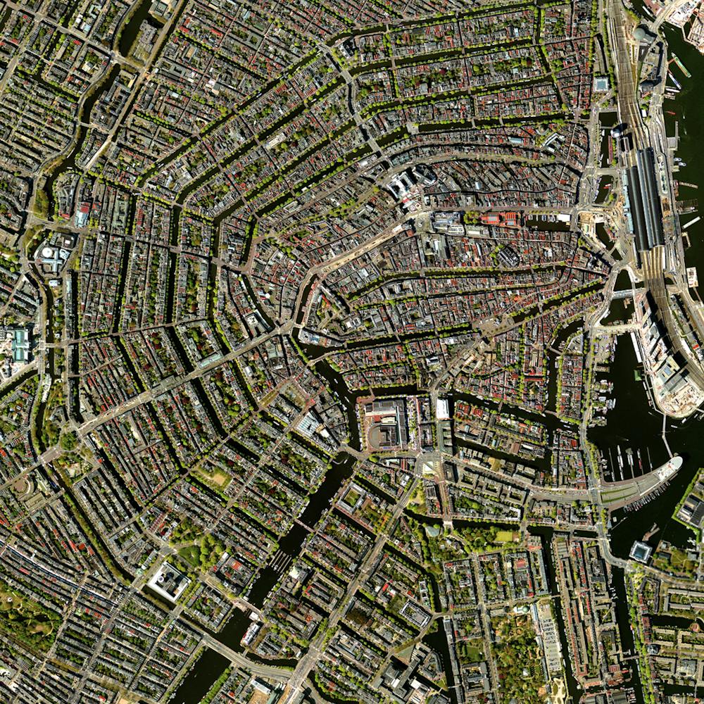
Anak Krakatoa Eruption (Juxtapose)
-6.102111°, 105.414222° - Sunda Strait, IndonesiaCheck out these amazing shots of the Anak Krakatoa caldera before and after its collapse in December 2018. The first Overview from January 2019 shows rust-colored sulfuric leftovers from the eruption in the surrounding water and the second, taken November 2017, shows smoke and lava flowing out of the caldera about a year before it collapsed. Anak Krakatoa is located in the Sunda Strait between the islands of Java and Sumatra, Indonesia.
Maxar Technologies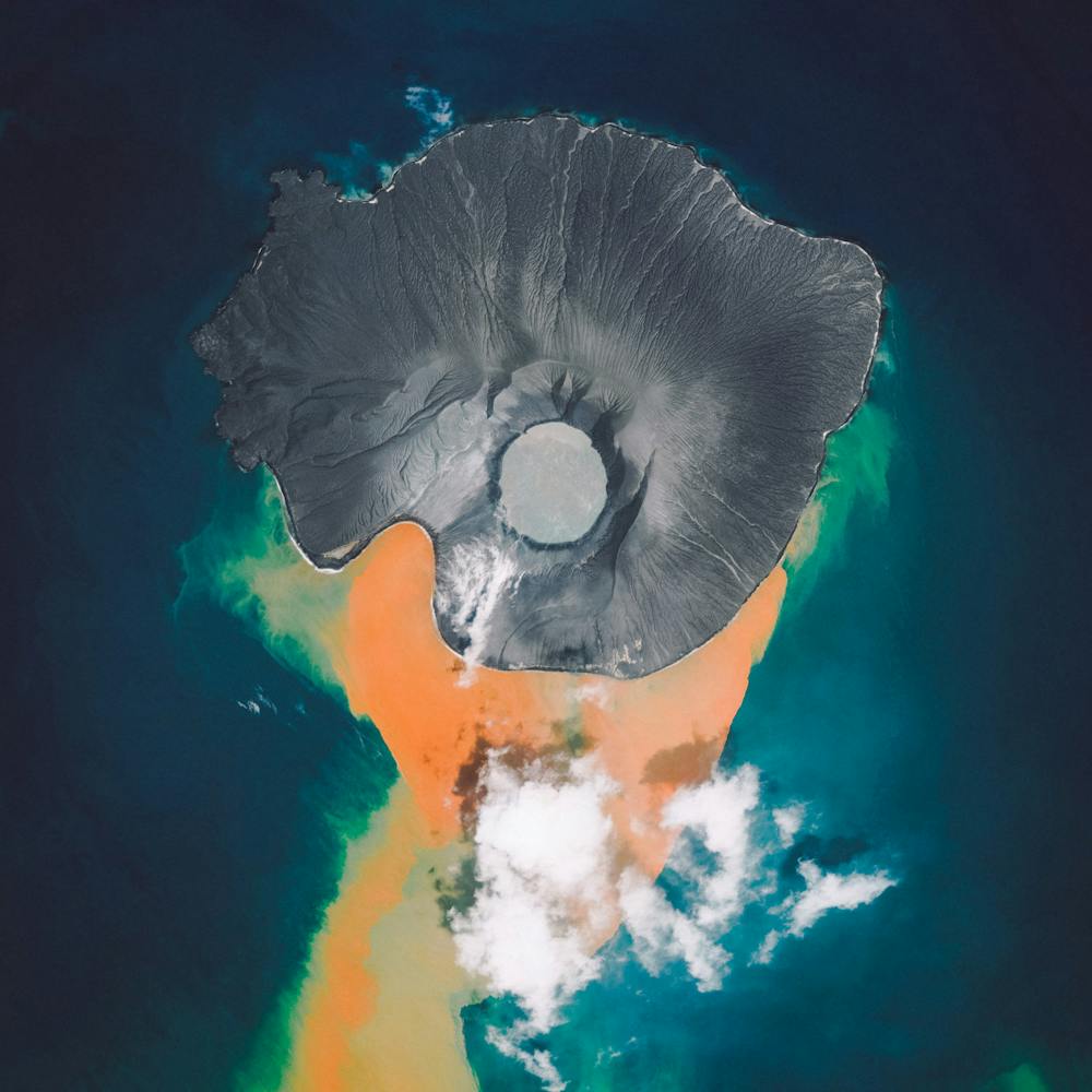
Ancient Ruins of Palmyra
34.547438°, 38.274651° - Palmyra, SyriaIn the past week, fighters from the Islamic State seized the ancient oasis city of Palmyra, Syria. Located at the crossroads of ancient Greek, Roman, Persian, and Islamic cultures, the city contains some of the world’s oldest known antiquities and ruins. The fabled amphitheater and the Temple of Bel seen in this Overview were completed as far back as 32 AD. ISIS despises antiquity since it represents culture that predates Islam and experts predict that they will vandalize and destroy these ancient ruins.
Maxar Technologies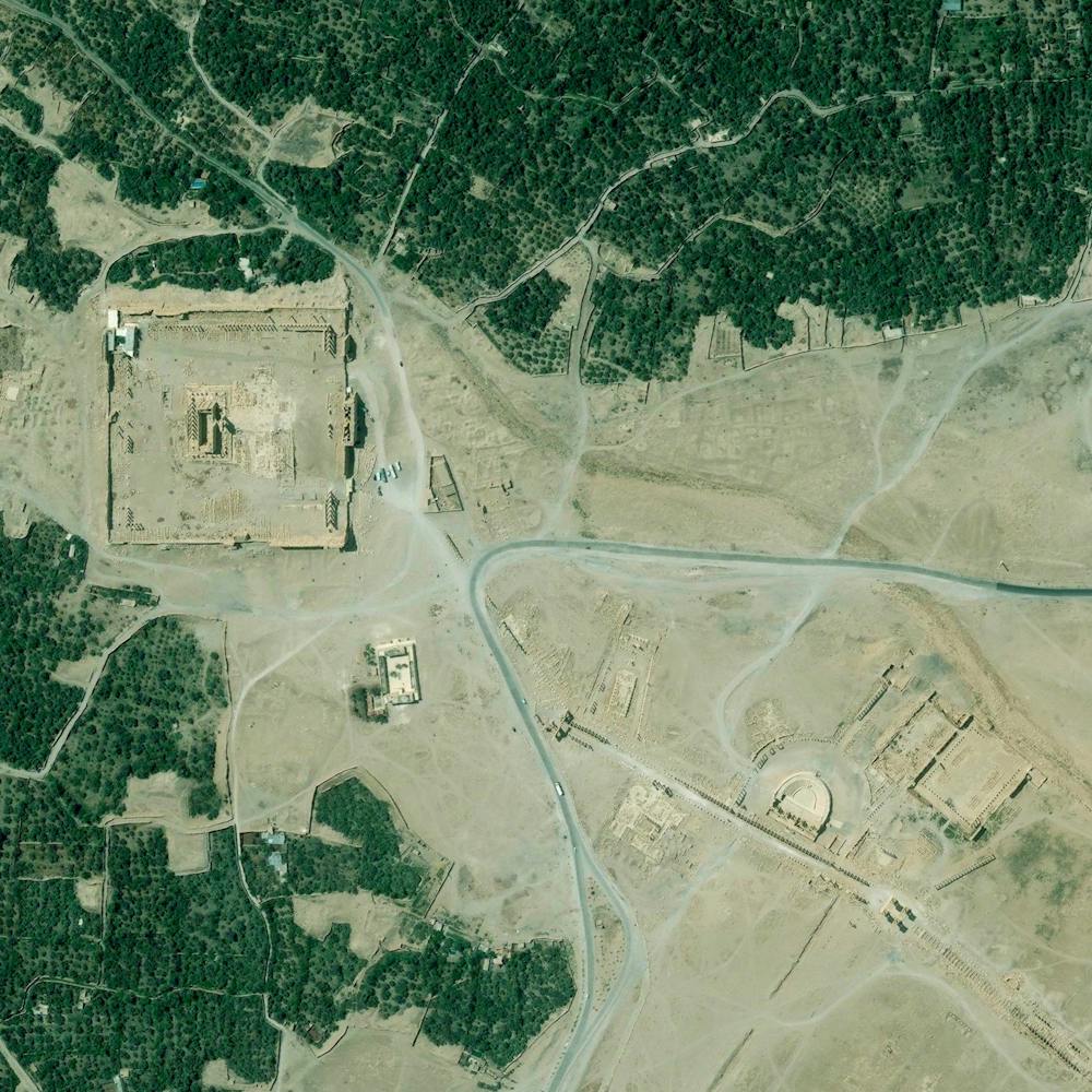
Andean Mountain Vineyards
-32.818694°, -70.835639° - ChileVineyards line the foothills of the Andean Mountains in Chile’s Valparaíso Region, roughly 55 miles (88 km) north of Santiago. Grapes grown in this wine region, called the Aconcagua Valley, are often irrigated with snow melt from surrounding mountains and have produced red wines of international acclaim.
Maxar Technologies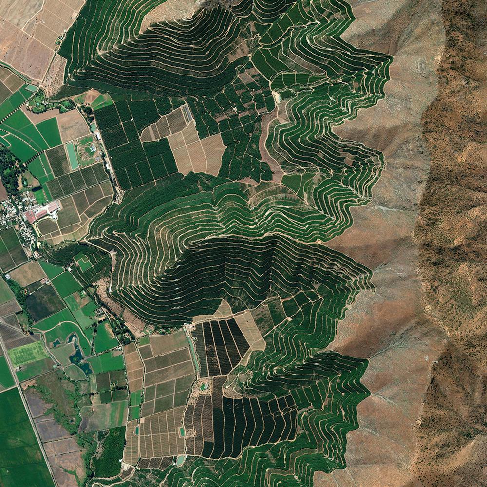
Angas Inlet Trees
-34.812361°, 138.540000° - Adelaide, AustraliaTrees grow inside the hull of a sunken ship in the Angas Inlet, an arm of the Gulf St. Vincent in Adelaide, Southern Australia. In this inlet and others nearby can be found the remains of more than 30 iron and wooden ships abandoned up until 1945. They serve as canoeing attractions and bird roosts for upwards of 200 species of local and migratory birds.
Nearmap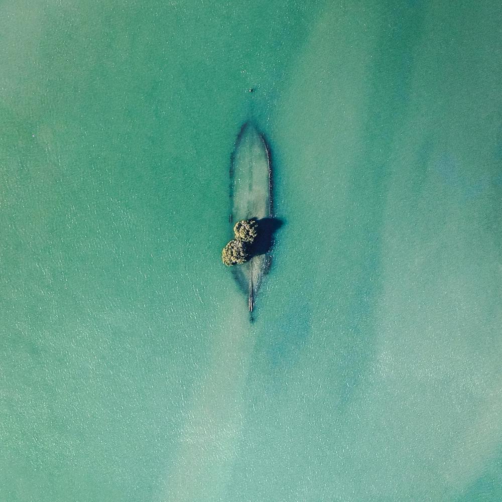
Angkor Wat
13.412500°, 103.866667° - Angkor, CambodiaAngkor Wat is a temple complex in Cambodia that is the largest religious monument in the world (first it was Hindu, then Buddhist). Constructed in the 12th century, the 820,000 square meter site features a moat and forest that harmoniously surround a massive temple at its center.
Maxar Technologies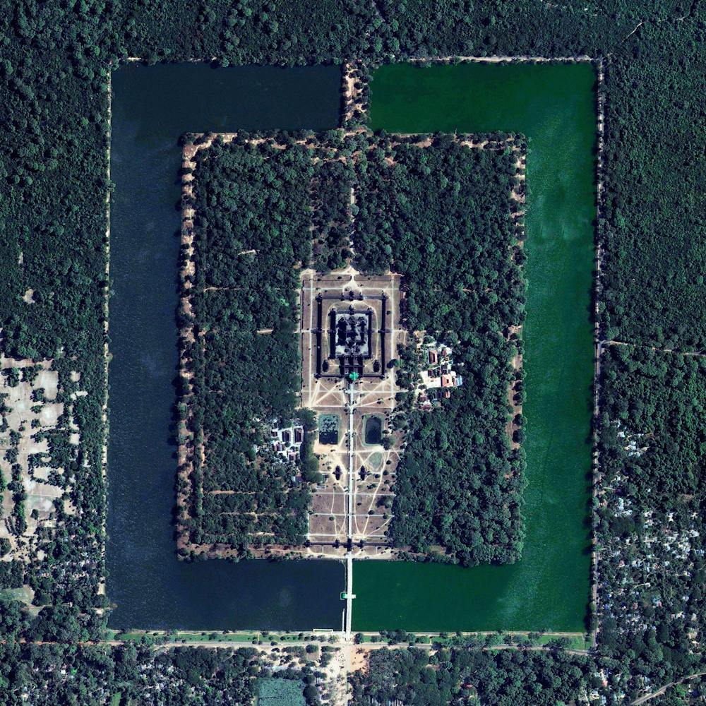
Ankara Residential Development
39.987500°, 32.850167° - Ankara, TurkeyA residential section of northern Ankara, Turkey, is shown in this Overview. Ankara is Turkey’s capital and second largest city (after Istanbul), with more than 5.4 million residents. Historically known as Angora, the city lends its name to Angora wool, which is shorn from Angora rabbits and the long-haired Angora goat – the source of mohair.
Maxar Technologies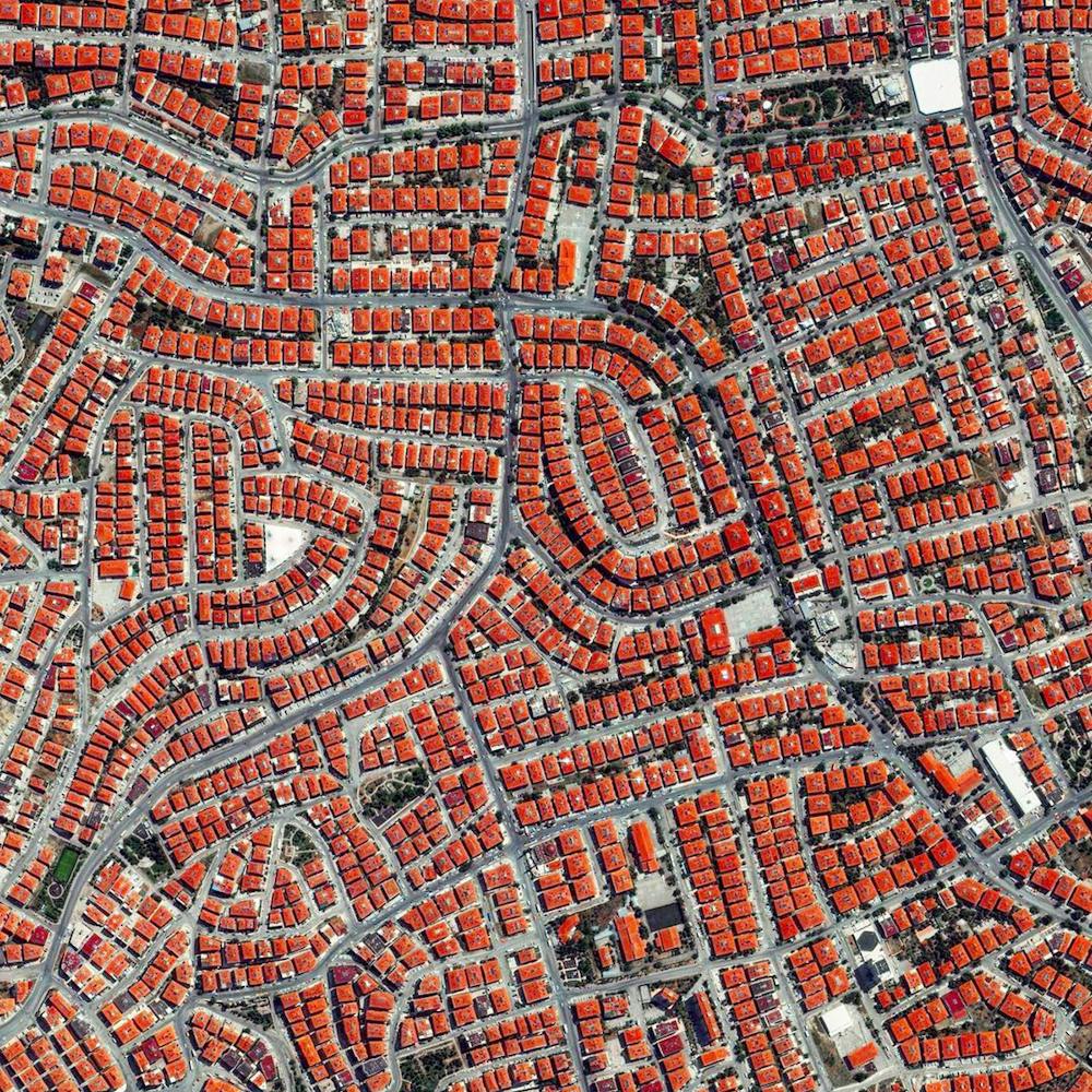
Antofagasta, Chile
-23.628354°, -70.474769° - Antofagasta, ChileWaves of the Pacific Ocean roll into the city of Antofagasta, situated on the coast of Chile. Because this area is situated in the Atacama Desert - the driest region in the world - it has incredibly sparse vegetation. In total, Antofagasta is home to roughly 400,000 residents and is the third largest city in the county.
Maxar Technologies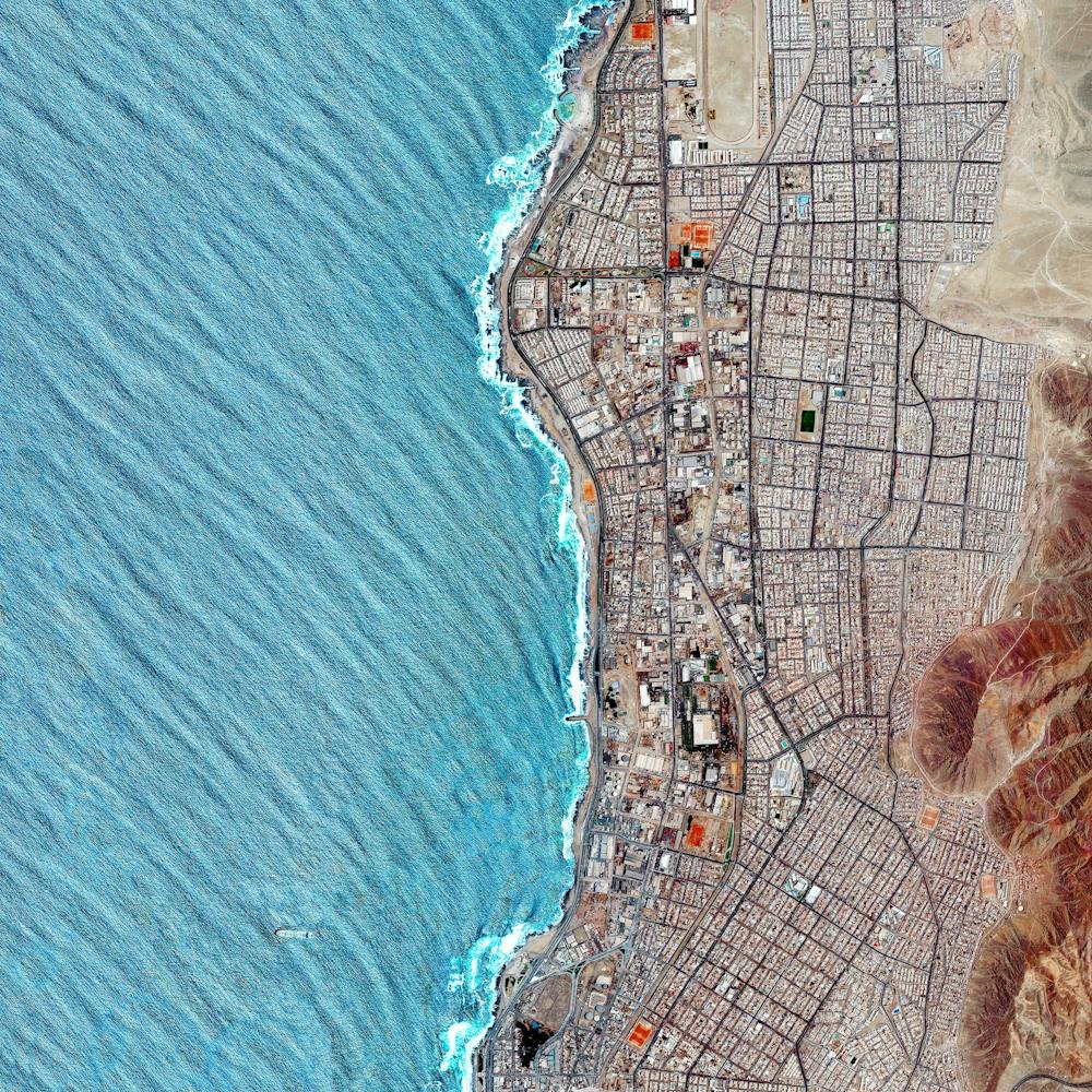
Apple Park
37.334185°, -122.009930° - Cupertino, California, USAApple Park is the corporate headquarters of Apple Inc., located in Cupertino, California, USA. It was opened to employees in April 2017, superseding the original "Apple Campus," which opened in 1993. Currently, more than 12,000 employees work in the four-story office building, which has a circumference of 1 mile (1.6 km) and a floor area of 2.8 million square feet (260,000 square meters).
Nearmap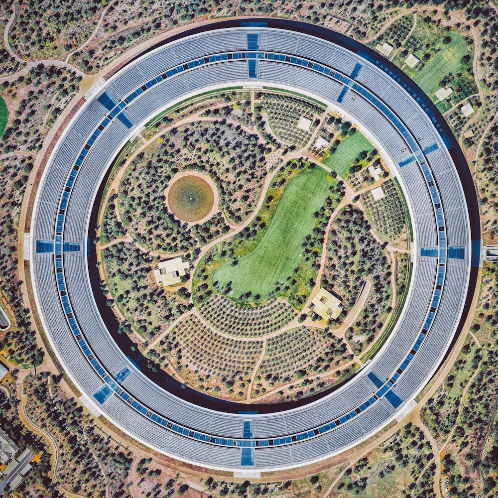
Aquatica Water Park
29.458417°, -98.698139° - San Antonio, Texas, USACheck out this Overview of Aquatica, a water park in San Antonio, Texas. Constructed in 2012, Aquatica boasts several water slides, pools, a 42,000-square-foot beach area, an aviary, and its signature “Stingray Falls,” a family raft ride that runs through an underground grotto full of stingrays and tropical fish.
Nearmap
Aral Sea
45.510578°, 58.757118° - Kazakhstan / UzbekistanThe Aral Sea was an endoheic lake (one with no outflow) located between Kazakhstan and Uzbekistan. Once the fourth largest lake in the world with an area of 26,300 square miles (68,000 sq. km), it has been shrinking since the 1960s after rivers that fed it were diverted by Soviet irrigation projects. By 1997, it had declined to 10% of its original size and split into four lakes, one of which has since disappeared. The shrinking of the Aral Sea has been called one of the planet's worst environmental disasters.
Maxar Technologies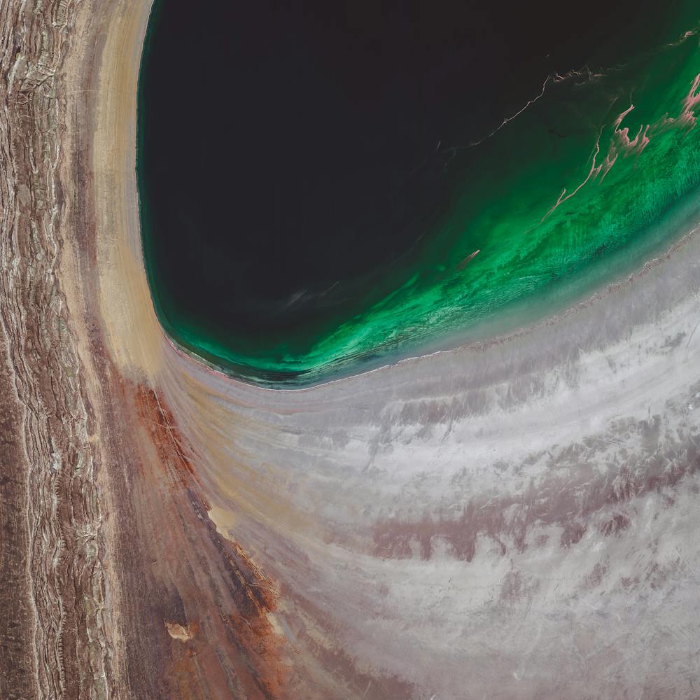
Arc De Triomphe
48.873778°, 2.295000° - Paris, FranceThe Arc de Triomphe is located at the center of 12 radiating avenues in Paris, France. Yesterday, millions took to these streets to celebrate France’s second FIFA World Cup victory (with a 4-2 final win over Croatia). Today, players and coaches will parade up the Champs-Elysees avenue, which passes diagonally through this Overview from bottom left to upper right.
Maxar Technologies
Arecibo Observatory
18.344167°, -66.752778° - Arecibo, Puerto RicoThe Arecibo Observatory is a radio telescope in the municipality of Arecibo, Puerto Rico. The telescope, which is 1,000 feet (305 m) in diameter, is used for three major areas of research — radio astronomy, atmospheric science, and radar astronomy. Last year, high winds associated with Hurricane Maria caused a line feed on the telescope to break and fall onto the primary dish, damaging about 30 of its 38,000 aluminum panels.
Maxar Technologies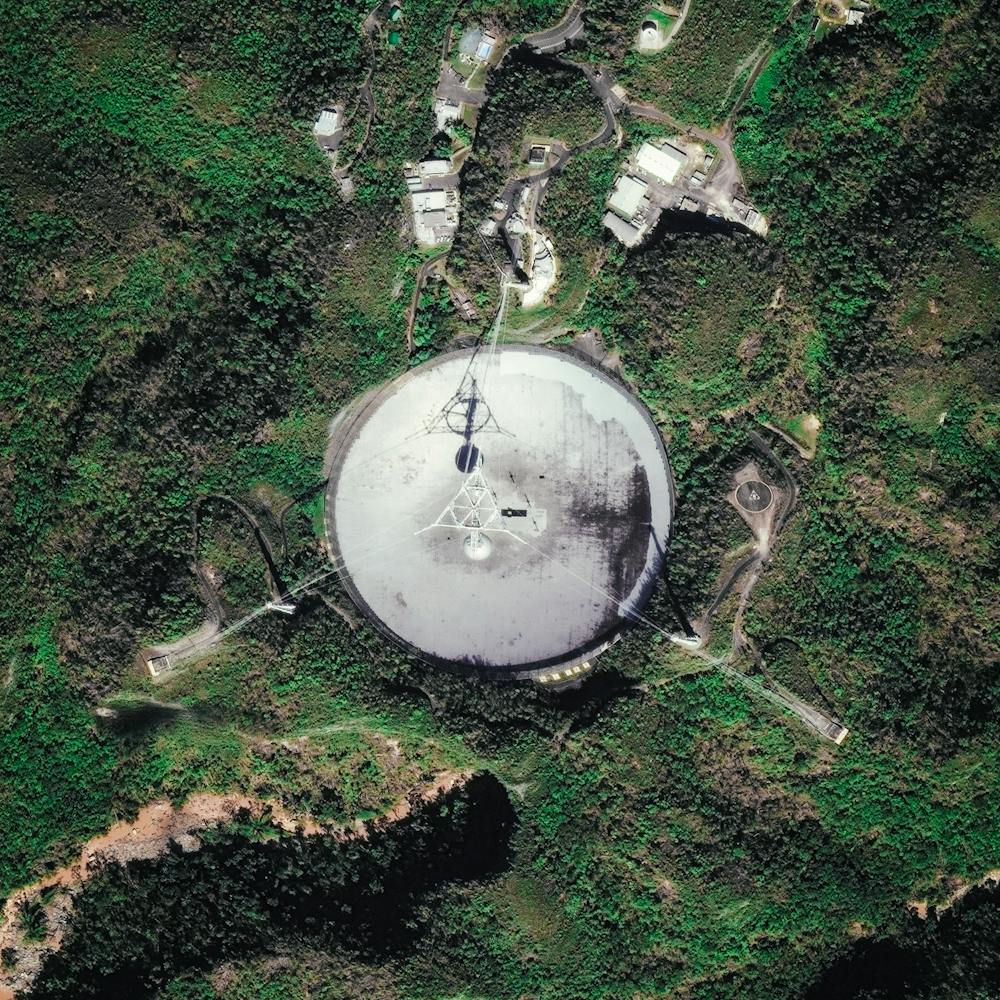
Arizona Rock Formations
36.052111°, -109.118611° - Arizona, USAIn this Overview, large rock formations are shown rising above the desert landscape in Northeastern Arizona, USA. This region is arid, largely void of greenery, and characterized by hills, mesas, buttes, cliffs and canyons. This particular outcrop is about 12.5 miles (20 km) due east of the Navajo National Monument, which contains the well-preserved cliff dwellings of the Ancestral Puebloan People.
Maxar Technologies