Explore
 Shop
Shop About
About Search
Overview Index
Port Hedland
-20.330472°, 118.569278° - Pilbara, Western AustraliaPort Hedland is the largest iron ore loading port in Australia and one of the largest in the world. Located in the Pilbara Region of Western Australia, the port recorded a throughput of more than 550 million tons between 2016 and 2017. In March 2017, Port Hedland had its record single shipment of 297,000 tons, which was aboard the HL Tubarao, an 1,115-foot-long (340 m) vessel from Panama.
Maxar Technologies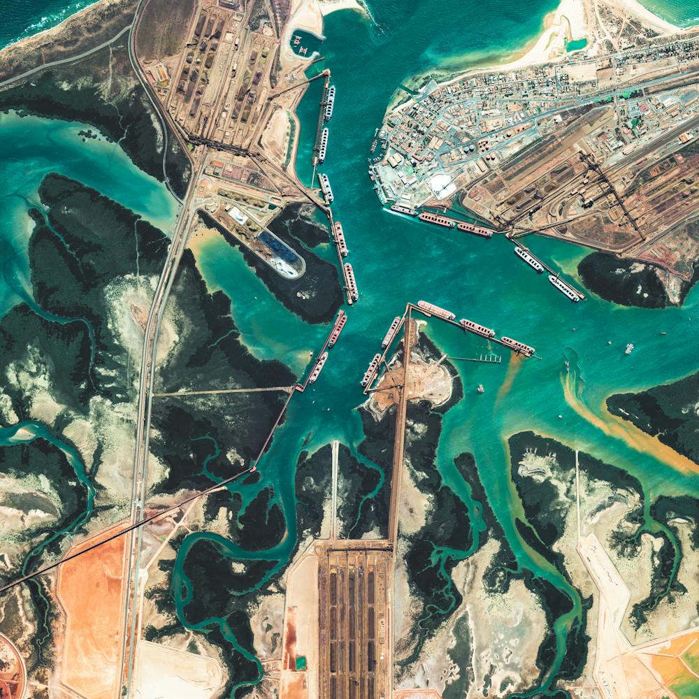
Port of Rotterdam Dry Terminal
51.938843°, 4.047934° - Rotterdam, NetherlandsThe dry terminal at the Port of Rotterdam in the Netherlands is the busiest transshipment facility of its kind in Europe - moving primarily coal and iron ore. The massive vessels that dock here carry up to 380,000 tonnes of these minerals to power plants and blast-furnaces in Germany, France, Belgium, and other European countries.
Maxar Technologies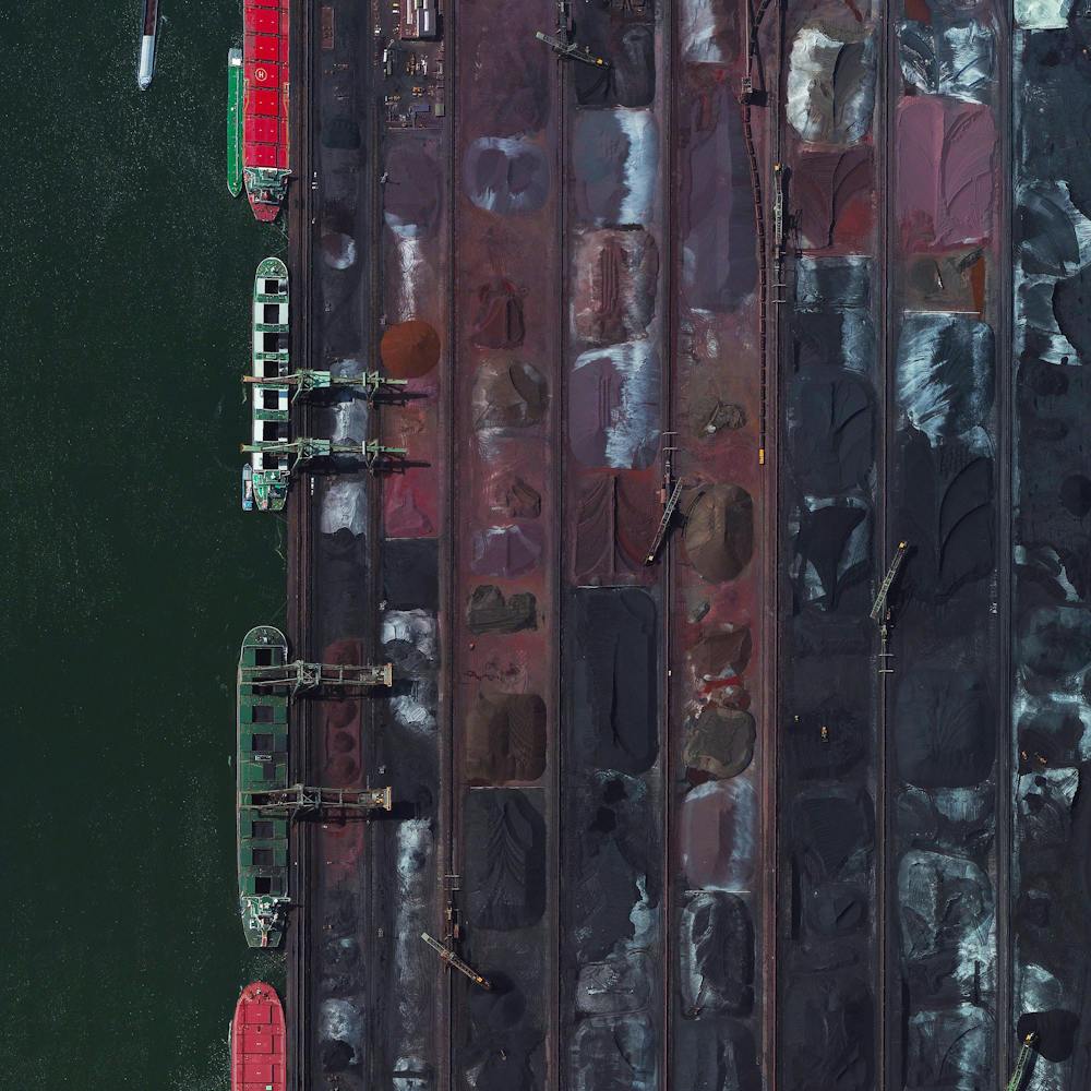
Port of Vancouver
49.017889°, -123.159583° - Vancouver, CanadaThe Roberts Bank Superport is a shipping facility in the Port of Vancouver, just offshore the city of Delta in British Columbia, Canada. It is home to the single busiest coal export terminal in North America, which typically ships more than 20 million tons of export coal a year. Currently, there are plans to expand the facility and add a new three-berth container terminal, which would provide an additional 2.4 million twenty-foot equivalent units of container capacity.
Nearmap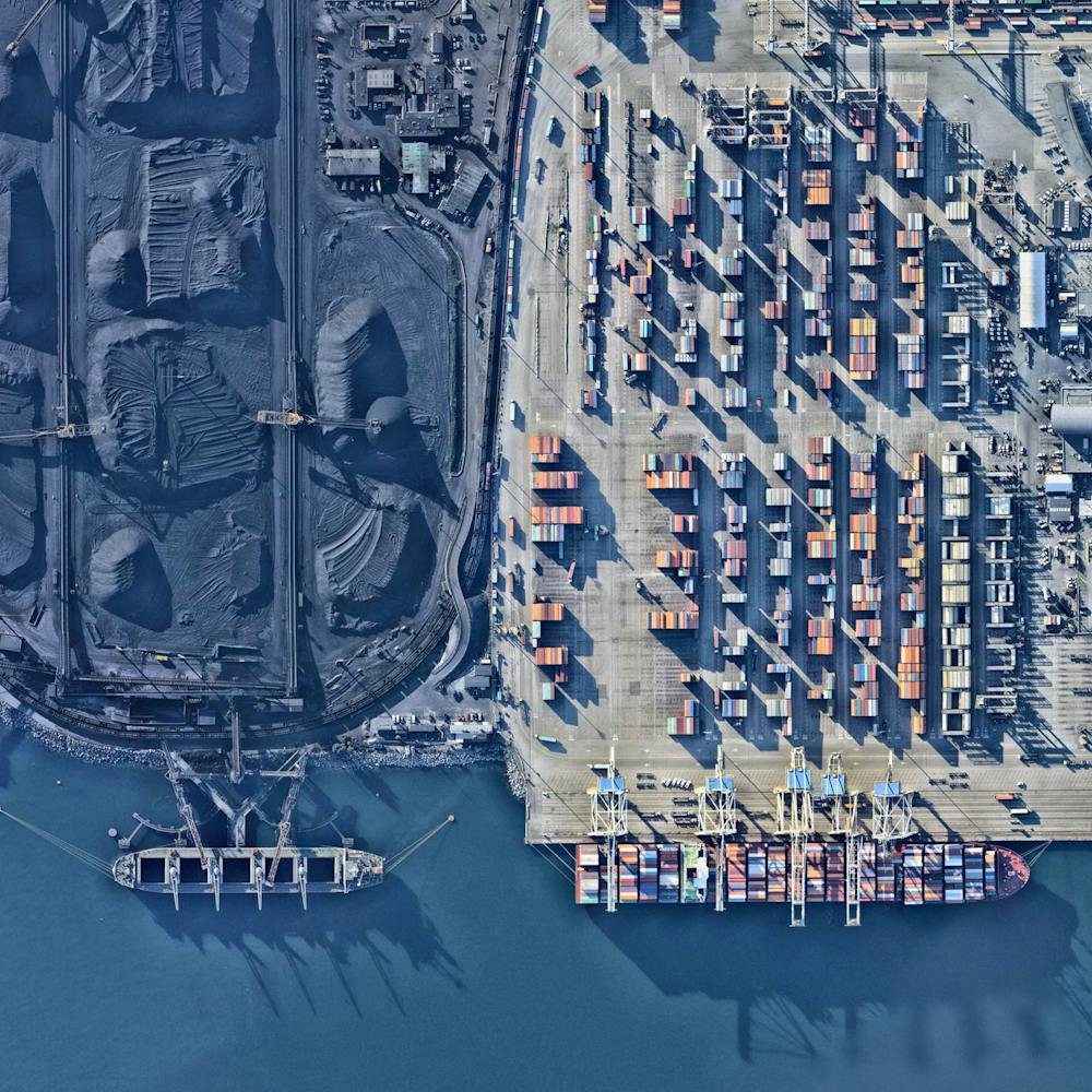
Potash evaporation ponds
38.483378°, -109.681333° - Moab, Utah, USABlue evaporation ponds are visible at the Intrepid Potash Mine in Moab, Utah, USA. The mine produces muriate of potash, a potassium-containing salt used widely by farmers in fertilizer. The salt is pumped to the surface from underground brines and dried in massive solar ponds that vibrantly extend across the landscape. As the water evaporates over the course of 300 days, the salts crystallize out. So why are you seeing such vibrant colors? The water is dyed bright blue to reduce the amount of time it takes for the potash to crystallize; darker water absorbs more sunlight and heat.
Maxar Technologies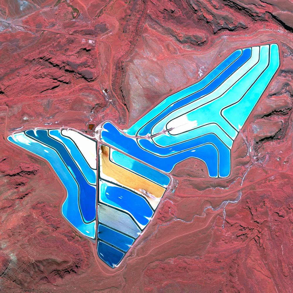
Qinhuangdao Coal Terminal
39.933622°, 119.683840° - Qinhuangdao, ChinaThis Overview shows the coal terminal at the Port of Qinhuangdao - the largest coal shipping facility in China. From here, approximately 210 million metric tons of coal are primarily transported to coal-burning power plants in the major cities in southern China each year. This figure is believed to account for approximately half of the country’s annual consumption.
Maxar Technologies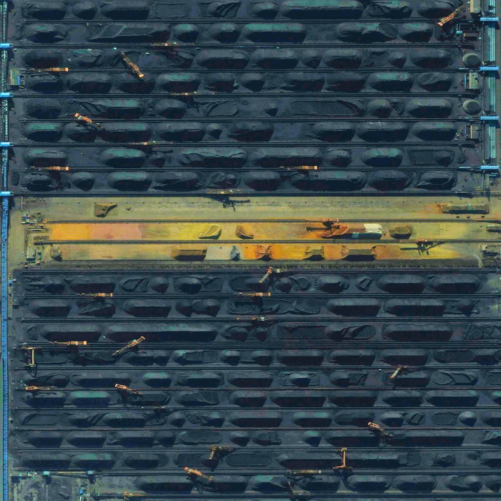
Rio Tinto River
37.730778°, -6.600667° - Huelva, SpainSince ancient times, the Rio Tinto Mines in Huelva Province, Spain, have been excavated for copper, silver, gold, and other minerals. They are named for the nearby Rio Tinto River, which — as a result of centuries of mining — is extremely acidic and has a distinct red-orange color. After being closed for more than a decade, the mines reopened in 2015 an remain operational today.
Maxar Technologies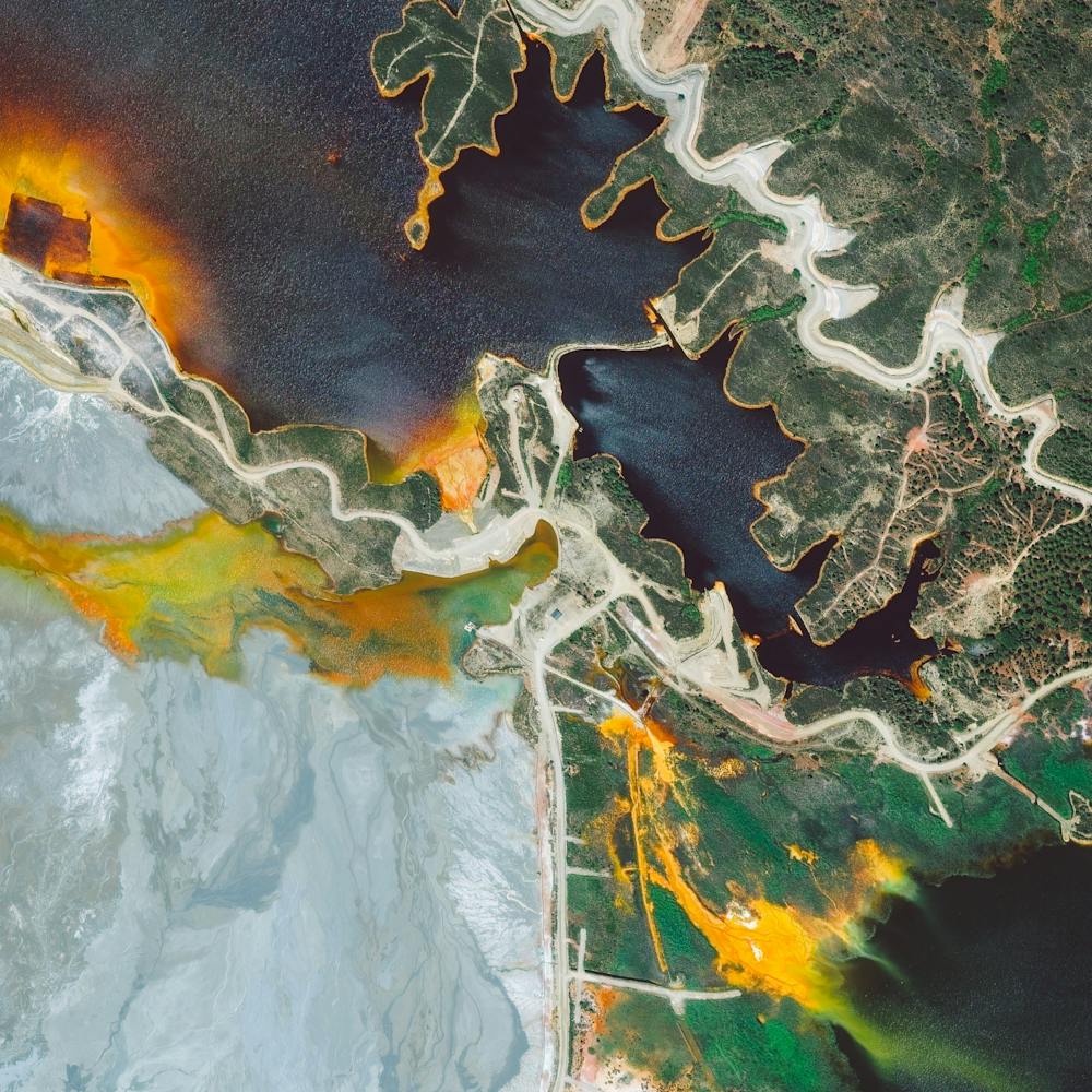
Salar de Atacama
-23.500000°, -68.250000° - ChileSalar de Atacama is the largest salt flat in Chile and the third largest in the world, spanning 1,200 square miles (3,000 sq. km). It is the world’s largest and purest active source of lithium, containing more than one-quarter of the world’s lithium reserves. In this Overview, lithium-rich waters sit in a series of evaporation ponds before being extracted as lithium carbonate — a key ingredient in specific industrial salts and chemicals, and in the production of lithium metal.
Maxar Technologies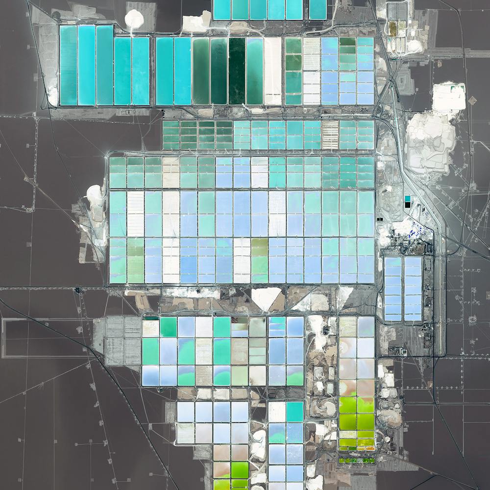
Salar de Uyuni
-20.133778°, -67.489139° - BoliviaSalar de Uyuni is the world’s largest salt flat, covering 4,086 square miles (10,582 sq. km) in southwestern Bolivia. This area is estimated to contain roughly 10 billion tons of salt, underneath which lies between 50% and 70% of the world’s known lithium reserves. The salar also contains large amounts of sodium, potassium, magnesium and borax.
Maxar Technologies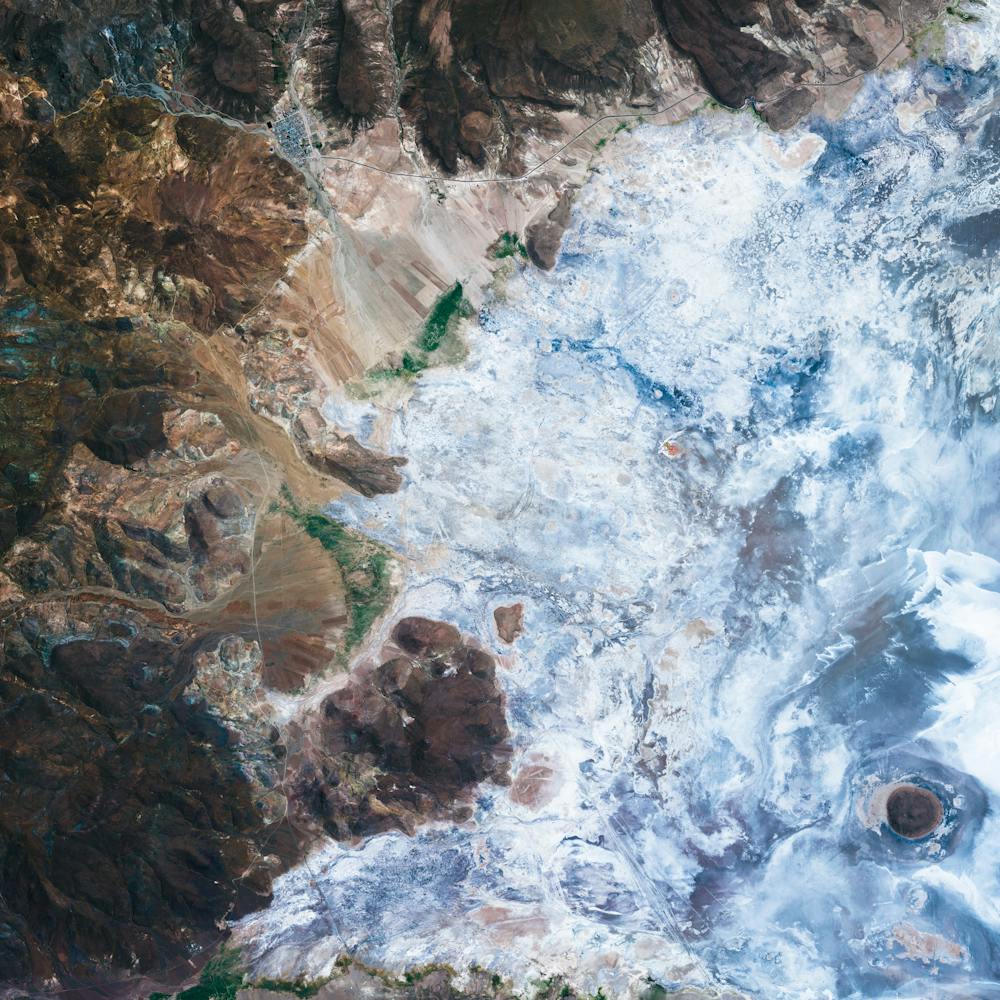
Salt Ponds
37.495364°, -122.160180° - San Francisco, California, USAA recent figure estimates that 80% of the San Francisco Bay wetlands area - approximately 16,500 acres - have been developed for salt mining. The ponds get their particular, vibrant colors from the micro-algae that live there and the species' tolerance to salinity. Areas that have a bright red hue are caused by the algae Dunaliella, which thrives in water with extremely high salt content. For a sense of scale, this Overview shows approximately one half of a square mile.
Maxar Technologies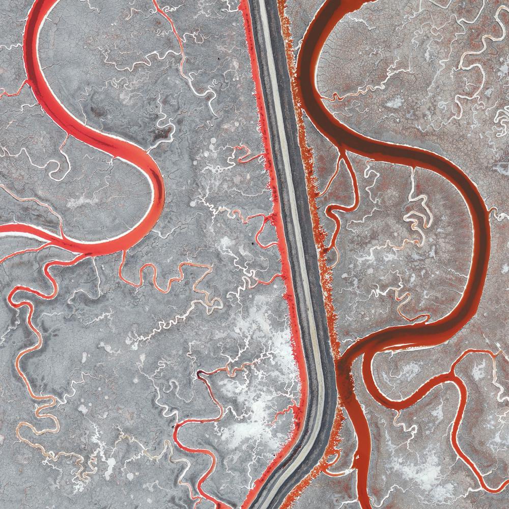
San Francisco Bay Salt Ponds
37.504215°, -122.036887° - California, USASalt ponds are seen on San Francisco Bay in northern California, USA. Here water is channelled into large ponds and exits through natural evaporation. The salt that remains can then be collected. The massive ponds get their vibrant reddish colors from the algae that thrive in the extremely salty water. Approximately 80% of this wetlands area – approximately 16,500 acres – has been developed for salt mining.
Maxar Technologies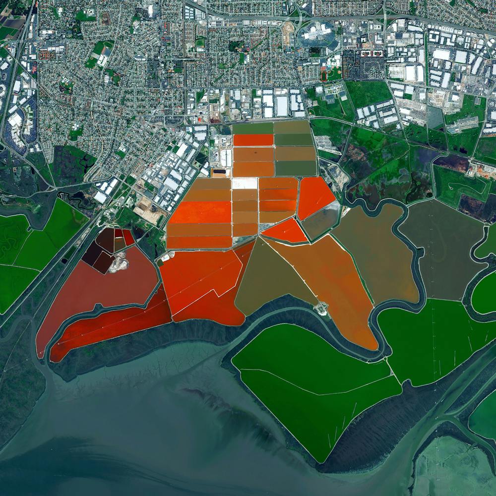
St. Kilda Evaporation Ponds
-34.748278°, 138.544556° - St. Kilda, South AustraliaCheck out the amazing shades of red in this saltwater evaporation lagoon near St. Kilda, South Australia. This small suburb of Adelaide is surrounded by such ponds, which are filled in the spring and harvested in autumn. Salt taken from the ponds used to make soda ash, a key ingredient in the production of glass, paper, soaps and detergents.
Nearmap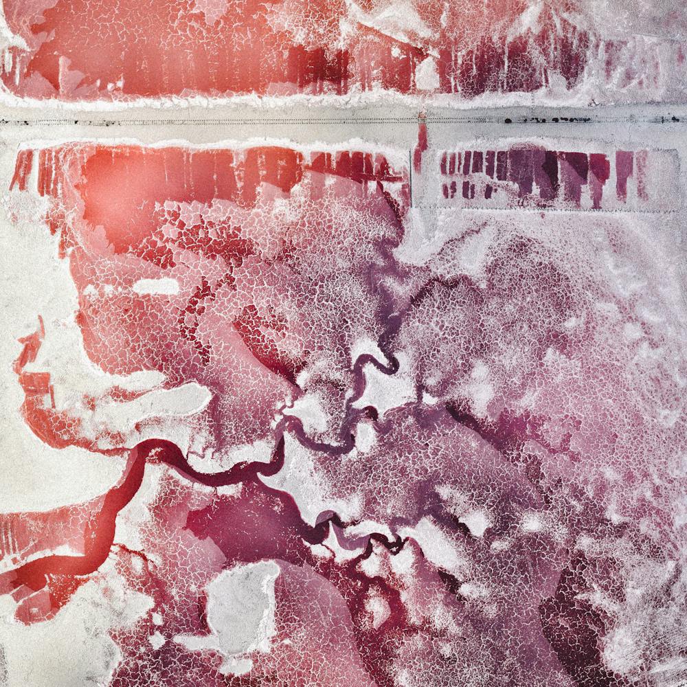
Tagebau Hambach Surface Mine
50.907783°, 6.523415° - Niederzier / Elsdorf, GermanyThis Overview captures bucket-wheel excavators at the Tagebau Hambach open-pit mine in Niederzier and Elsdorf, Germany. These massive machines (up to 315 feet tall and 730 feet long) continuously scoop materials from the surface in order to extract lignite. Lignite, often referred to as “brown coal,” is a soft combustible sedimentary rock that is formed from naturally compressed peat and is used as a fuel for steam-electric power generation.
Maxar Technologies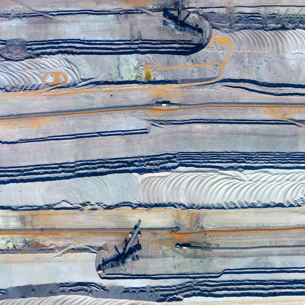
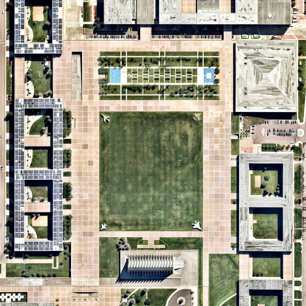
United States Air Force Academy
39.008472°, -104.888667° - Colorado Springs, Colorado, USAThe United States Air Force Academy covers 29 square miles (75 sq. km) in Colorado Springs, Colorado. This segment of the campus, known as the Cadet Area, features the well-known Cadet Chapel, dormitories, academic buildings, and dining, entertainment and sports facilities. At the center of the Cadet Area is a large, grassy common area known as The Terrazzo.
Nearmap