Daily
One regular dose of Earth from above
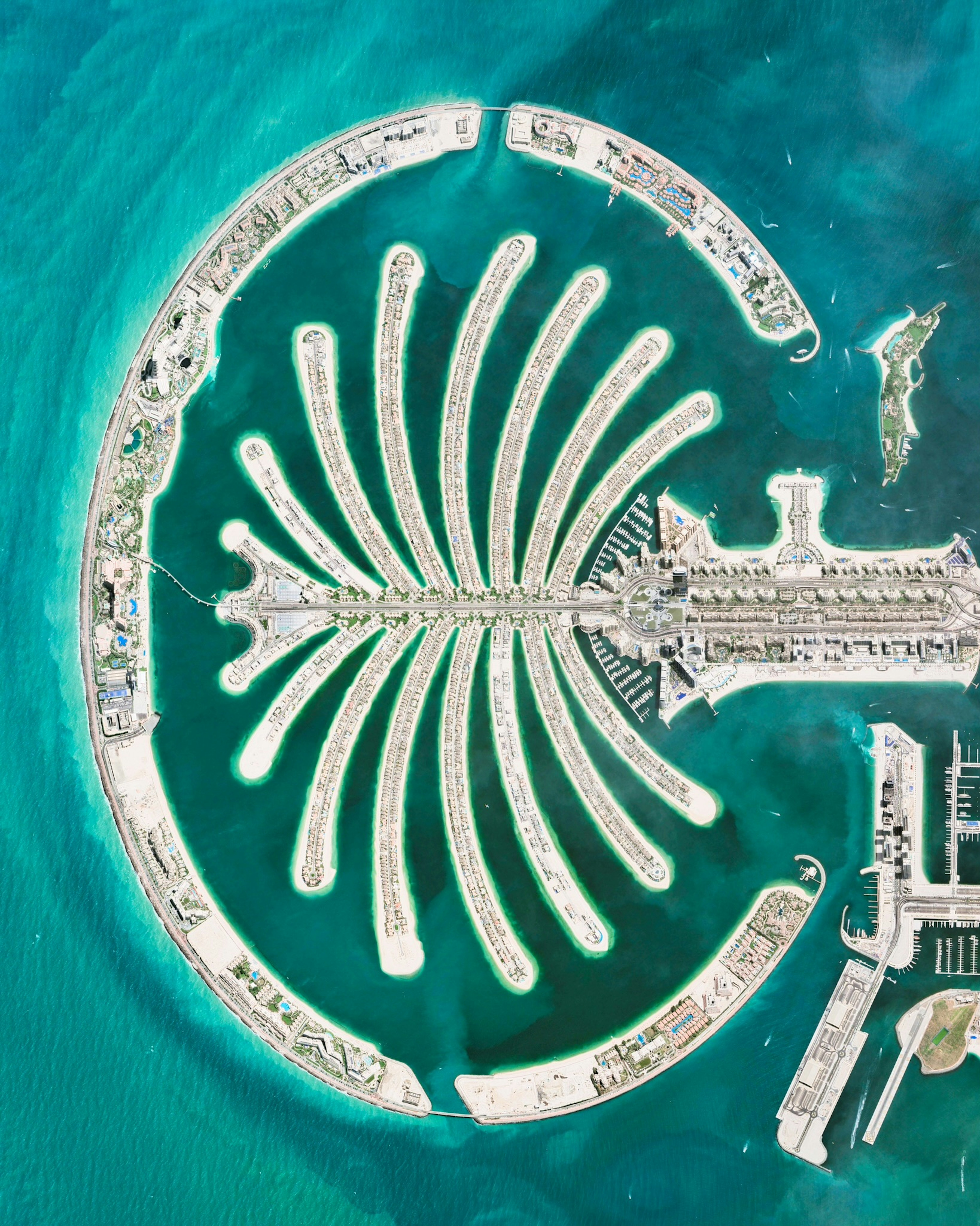
Palm Jumeirah
25.114667°,55.137797° - Maxar
The Palm Jumeirah is an archipelago of artificial islands on the Persian Gulf in Dubai, United Arab Emirates. It was created with 3.3 billion cubic meters of sand and 7 million tons of rock. The Palm’s 17 fronds are home to around 1,500 beachfront mansions, and its trunk contains a further 6,000 apartments.
Himalayas Low-Angle
27.983333°,86.916667° - Planet
The Himalayas, with Mount Everest at top center, captured by satellite at a low angle. The range contains some of Earth’s highest peaks, including over 100 that exceed 23,600 feet (7,200 meters) in elevation. The Himalayas abut or cross five countries: Bhutan, India, Nepal, China, and Pakistan.
Turkey-Syria Earthquake
37.572867°,36.921639° - Planet
Major damage is seen in Kahramanmaraş, Turkey following yesterday’s earthquakes in Turkey and Syria. Rescue efforts continue as the death toll rises above 10,000 and thousands of buildings lie collapsed across the country. Kahramanmaraş Stadium, seen here in the upper right, is one of many temporary shelters set up to house and aid survivors of the disaster.
Desert Shores
36.212194°,-115.268917° - Nearmap
Desert Shores is a 682-acre master planned community in northwest Las Vegas, Nevada. Constructed in 1988, it has more than 3,300 housing units ranging from condominiums to large, custom-built homes. At the center of Desert Shores are four man-made lakes, the largest of which — Lake Jacqueline — is flanked by the other three.
Venice Beach Skatepark
33.987100°,-118.475500° - Nearmap
Venice Beach Skatepark is a public skatepark in the Venice neighborhood of Los Angeles, California. The 16,000-square-foot (1,486-square-meter) space cost $3.5 million to build and is reportedly the most expensive skatepark in the world. Modern skateboarding emerged in Southern California in the 1950s, when surfers were looking for an activity while waves were flat.
Palmanova
45.904892°,13.317671° - Maxar Technologies
The town of Palmanova, Italy is recognized by its concentric layout known as a star fort. The rationale for this construction was that an attack on any individual wall could be defended from the two adjacent star points by shooting the enemy from behind. The three rings that surround Palmanova were completed in 1593, 1690, and 1813.
Mogan Plain
39.396246°,48.240372° - Maxar
This Overview shows colorful patterns of farmland in northwestern Iran, close to the Azerbaijan border. This area is located within the Moḡān Plain, a large fertile steppe along the bank of the Aras River. It provides important pasture and grazing land for sheep, goats and other livestock.
Brunt Ice Shelf
-75.140121°,-24.808559° - European Space Agency
Last week, the Brunt Ice Shelf broke away from Antarctica after many years of gradual fracturing. The calving formed a new iceberg twice the size of New York City, with an area of about 600 square miles (1,550 square kilometers). Scientists from the British Antarctic Survey say this event is the result of natural forces, not climate change.
Adam’s Bridge
9.079350°,79.562255° - Planet
Adam's Bridge, also known as Rama's Bridge, is a chain of natural limestone shoals between Pamban Island, off the southeastern coast of India, and Mannar Island, off the northwestern coast of Sri Lanka. The entire bridge is 30 miles (48 km) long and is rarely submerged by more than three feet (a meter) of water. Geological evidence suggests that the bridge is a former land connection between India and Sri Lanka.
Bora Bora
-16.501000°,-151.740000° - Maxar
Bora Bora is a 12-square-mile (30-square-km) island chain in the Society Islands of French Polynesia. The main island, which has an extinct volcano at its center, is surrounded by a lagoon and a barrier reef. Bora Bora is a major international tourist destination, famous for its aqua-centric luxury resorts. It has about 10,600 permanent residents but is visited by hundreds of thousands of travelers each year.
Buenaventura
3.877222°,-77.026667° - Planet
Buenaventura is a city on the Pacific Coast of Colombia, in South America. Its urban area extends from the mainland onto Cascajal Island, where the Port of Buenaventura handles nearly 60% of all Colombian sea trade. About 432,000 people live in Buenaventura.
Tien Shan Mountains
41.723194°,88.323916° - Maxar
The eastern Tien Shan Mountains, located in Xinjiang, China, is characterized by rows of mountain ranges with intervening valleys and basins. This Overview shows a valley at the edge of the Kuruktag Range. Due north of this range is the Turfan Depression, which contains the lowest point in Central Asia — 505 feet (154 meters) below sea level.
Omaha
41.258611°,-95.937500° - Google Timelapse
Omaha, Nebraska has steadily grown and expanded in recent decades, its population doubling from 526,000 to about 1 million since 1984. A growing number of immigrants have made their homes in the city, with the largest South Sudanese community in the US located in Omaha. The Missouri River, seen at the top of this Overview, forms Omaha’s (and Nebraska’s) eastern border.
Carlsbad Potash Ponds
32.510823°,-103.955313° - Maxar
Evaporation ponds are seen at the Intrepid Potash Mines near Carlsbad, New Mexico, USA. These mines produce muriate of potash and sulfate of potash magnesium, two mineral salts used in fertilizer. Salt is dried in these massive solar ponds after being pumped to the surface from underground brines. Water in the ponds is dyed with vibrant colors to reduce the time it takes for potash to crystallize — darker water absorbs more sunlight, causing it to evaporate more quickly.
Elizabeth Marine Terminal
40.674111°,-74.145861° - Nearmap
Shipping containers at Elizabeth Marine Terminal in Elizabeth, New Jersey. The massive facility handles more than 2.3 million twenty-foot equivalent containers every year. Working with the adjacent Port Newark, it is the principal container ship facility for goods entering and leaving New York metropolitan area.
Niagara Falls
43.077107°,-79.075506° - Nearmap
Niagara Falls is the collective name for three waterfalls that straddle the border between Ontario, Canada and the United States. Horseshoe Falls is seen here. The falls have the highest flow rate of any waterfall in the world, with a vertical drop of more than 165 feet (50 m). The Maid of the Mist, also visible here, is a boat that has carried passengers into the rapids below the falls since 1846.
Bangladesh Floating Gardens
24.947572°,91.616831° - Maxar
Floating gardens in Habiganj District, Bangladesh form a colorful mosaic when seen from the aerial perspective. This part of the country is characterized by alluvial plains criss-crossed by numerous rivers and streams, making hydroponic farming practical and less susceptible to flooding. Bangladesh is among the top producers of rice, potatoes, tropical fruit, jute and farmed fish.
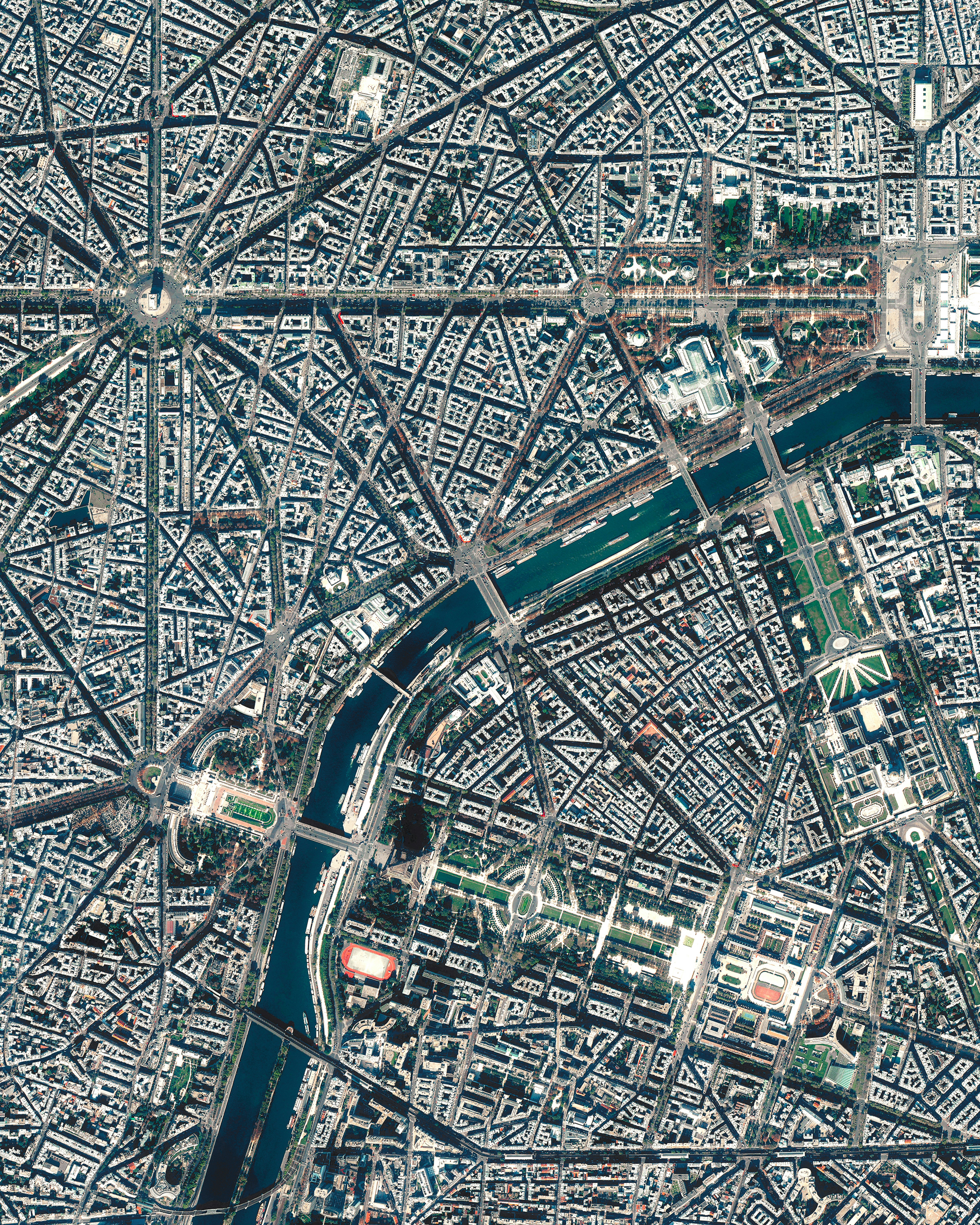
Paris
48.865797°,2.330882° - Maxar
The street plan and distinctive appearance of central Paris, France is largely due to the vast public works program commissioned by Emperor Napoléon III and directed by Georges-Eugène Haussmann, between 1853 and 1870. Haussmann’s renovation of Paris included the demolition of crowded and unhealthy medieval neighborhoods and the building of broad, diagonal avenues, parks, squares, sewers, fountains, and aqueducts. Both the Eiffel Tower and Arc de Triomphe are visible in this Overview.
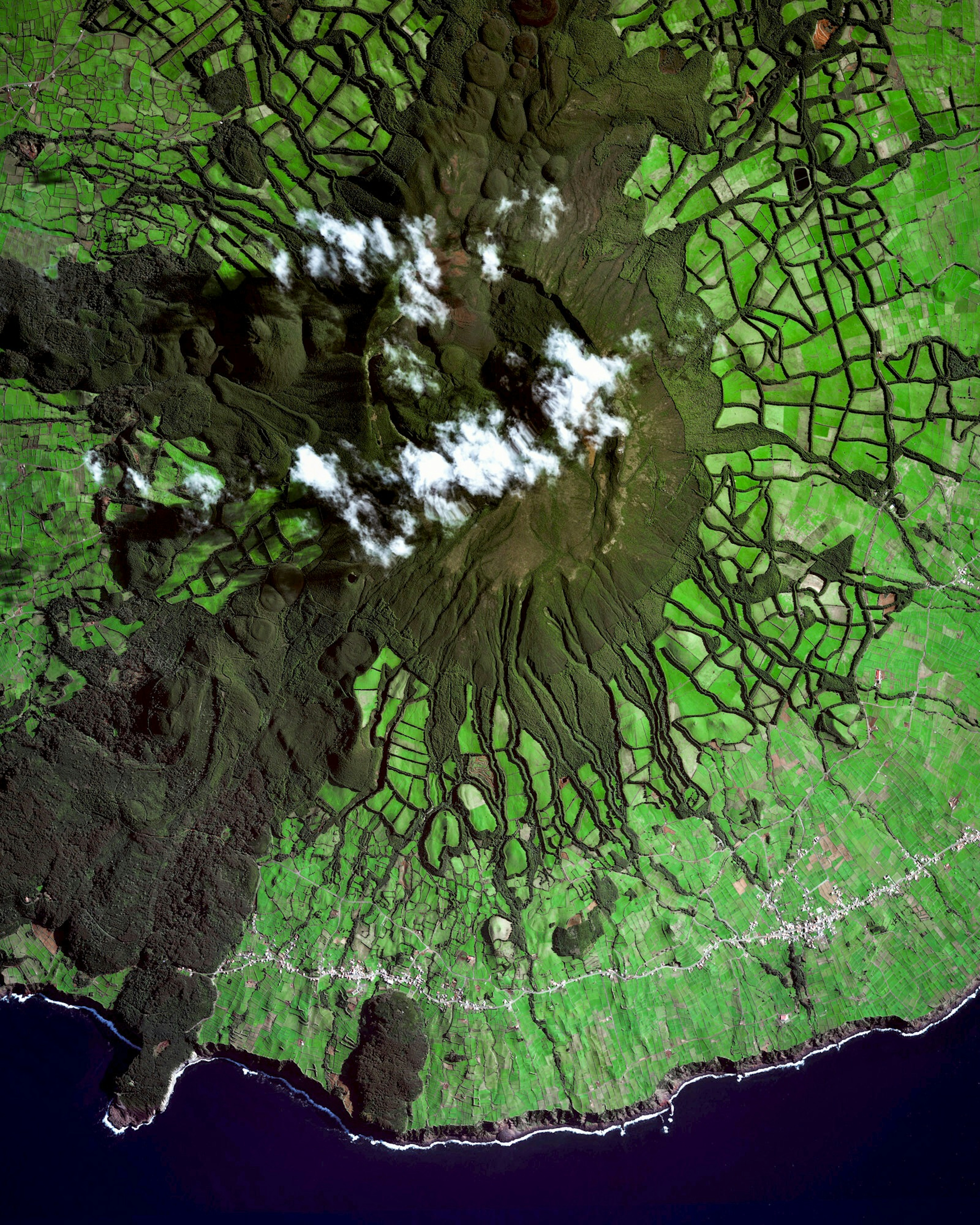
Serra de Santa Bárbara Volcano
38.729723°,-27.333654° - Maxar
Serra de Santa Bárbara is an inactive volcanic peak on the island of Terceira in the Azores, Portugal. At 3,350 feet (1,021 m), it is the highest point on the island. Just below the peak is the Santa Bárbara Caldera, which is roughly 0.6 miles (1 km) in diameter and has two smaller peaks in its center.
Citadel of Aleppo
36.199329°,37.163396° - Maxar
The Citadel of Aleppo is a large medieval fortified palace in the center of the old city of Aleppo, Syria. It is considered one of the oldest and largest castles in the world, with human activity dating back to at least 2500 BC. The limestone structure sits atop a 130-foot-tall (40-meter) mound, surrounded by a 72-foot-deep (22-meter) and 98-foot-wide (30-meter) moat dating from the 12th century.


